
Ancestors on both my mother and father’s sides have lived around Mjøsa – Norway’s largest lake – for hundreds (if not thousands) of years.
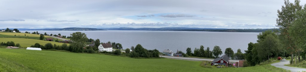
Mjøsa is massive – from end to end 73 miles (117 km). And at its deepest point, it’s nearly 1,500 feet (450 m). The lake is the dividing line between two traditional regions in Norway: Oppland on the west and Hedmark on the east. As of 2020, the two have been merged into the newly minted county of Innlandet. Technically, Innlandet is Norway’s only landlocked county, but in the years before railways, Mjøsa and its connecting rivers served as the region’s link to Oslo and the sea.
Over the next couple days I’ll be visiting the towns around Mjøsa where my ancestors lived, but before I do that, I thought a quick orientation to the area might be helpful.
For any of you related to me through my mother’s side – specifically my mother’s father’s side – the relevant location is the countryside west of Gjøvik. Using a yellow circle on the map below I’ve marked the approximate location of our family’s origins in Vardal Parish. Vardal is where my great-grandma Elvina Anderson Smith’s father Anton (Andreasen) Anderson came from.
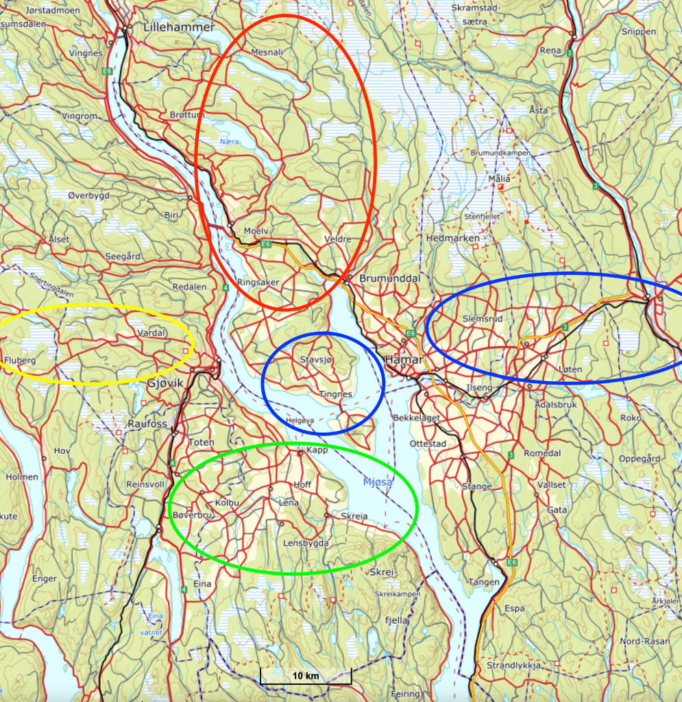
For any of you related to me through my father’s father’s side, there are multiple relevant locations. The red circle at the top of the map indicates the general area in Ringsaker Parish where my paternal grandfather’s paternal grandparents, Ole Johannesen (Roterud) Rude and Klara Hansdatter Bokrudstad, came from: Veldre and Ringsaker. The green circle at the bottom of the map marks the place where my paternal grandfather’s mother’s family originated — Østre Toten. And the blue circles indicate roughly where my paternal grandfather’s biological father’s family came from in Nes, Hamar, Løten and Elverum.

Leave a reply to Jesse Rude Cancel reply