-
The search for the source (part 2)
For most of its course, the Mississippi River runs from north to south. But things are different at the headwaters. Here the Mississippi is a meandering stream that arcs vaguely north and east before turning south. Through marshes, woodlands and glacial lakes, this little river forms a giant question mark across north central Minnesota.
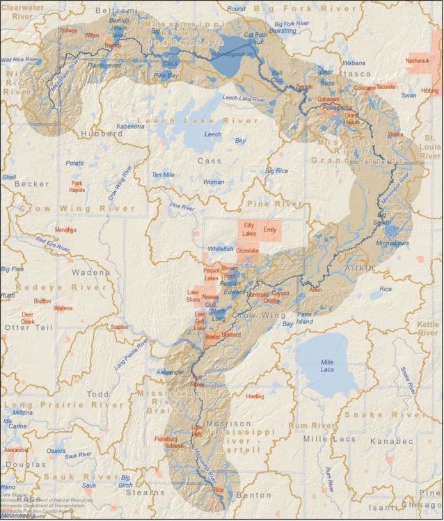
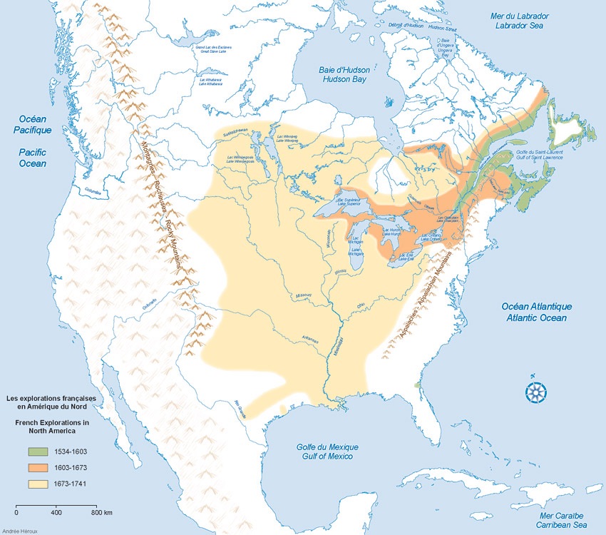
The Mississippi headwaters (map downloaded from this site) Part 2: A Little Mystery
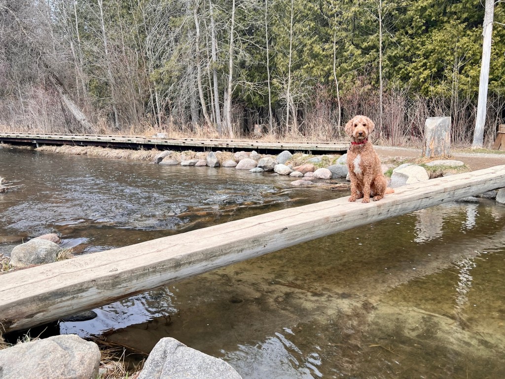
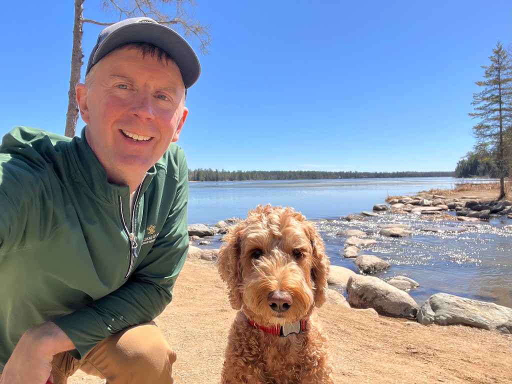
My dog Spence and I traveled to the headwaters this past week to find out what lies at the end of the question mark. It’s an age-old quest, and we’re hardly the first to do it (for a brief history, see Part 1 of this post). But our little expedition seemed to produce more questions than answers.
For instance… Where does a river begin? It’s a simple enough question, but for individual rivers the answer is dictated as much by history and tradition as it is by hydrology. Hydrologists tell us that the difference between a river’s main stem and a tributary is that the main stem is longer. That is to say, where two rivers come together, the one with the more remote source should be the main stem. But in approximately 0% of the world’s rivers was a river fully mapped out and then named accordingly. Rivers often have traditionally designated tributaries, main stems and sources that don’t meet the standards of hydrologists. The Mississippi falls into this category, as its main tributary, the Missouri River, has the more remote headwaters.1 But the Mississippi gets away with this because it contributes a larger volume of water than the Missouri at the confluence and, well, it just looks like the main stem. The Missouri flows in from an odd angle.
Other rivers provide other excuses. The traditionally designated sources of the Nile, the Ganges, and the Thames are all, by hydrological standards, wrong. But no one pays the poor hydrologists much heed.
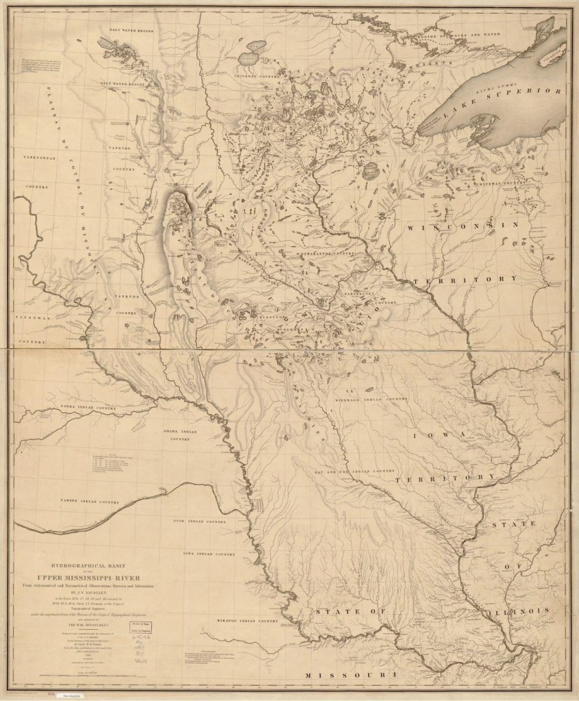
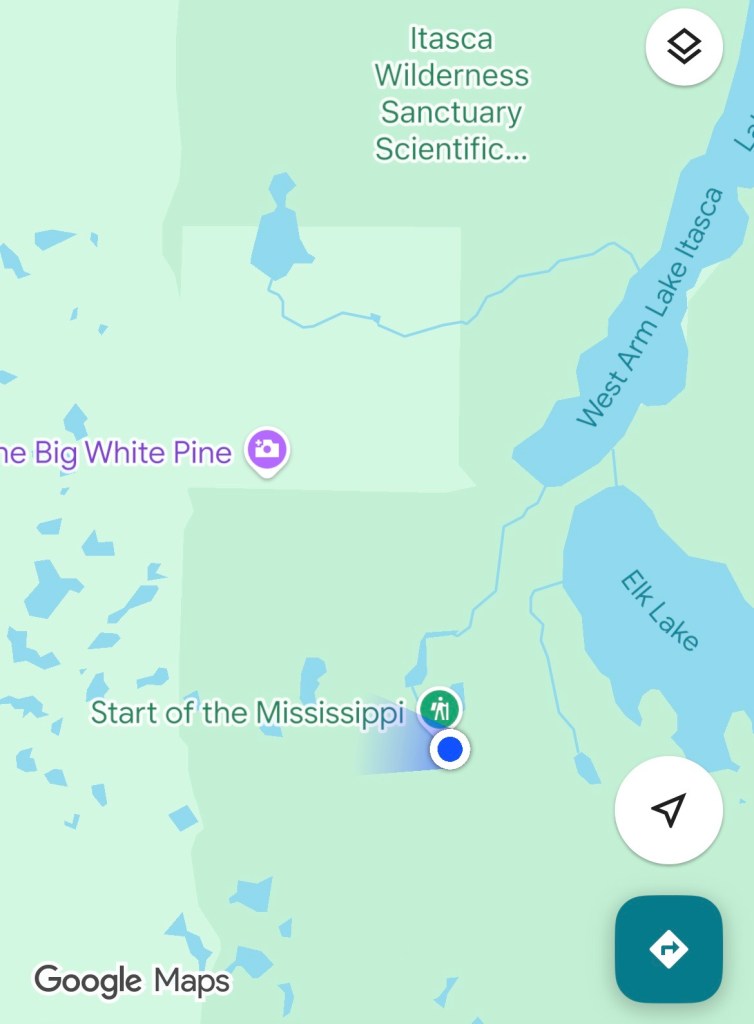
Nicollet’s extraordinary map (image source is here) After Schoolcraft’s 1832 expedition, a variety of characters explored the Mississippi headwaters and asserted competing claims to the “true source”. My favorite is Joseph Nicollet. Having lost his fortune in France, Nicollet emigrated to the U.S. and obtained work as a cartographer. In his all-too-brief life he completed three expeditions to the Upper Mississippi and created the first accurate maps of the region. On his 1836 expedition, he mapped the headwaters, retracing Schoolcraft’s route and confirming Itasca as the source. But he did note that a small stream flowed into Itasca from the south, which he referred to as an “infant Mississippi”.2
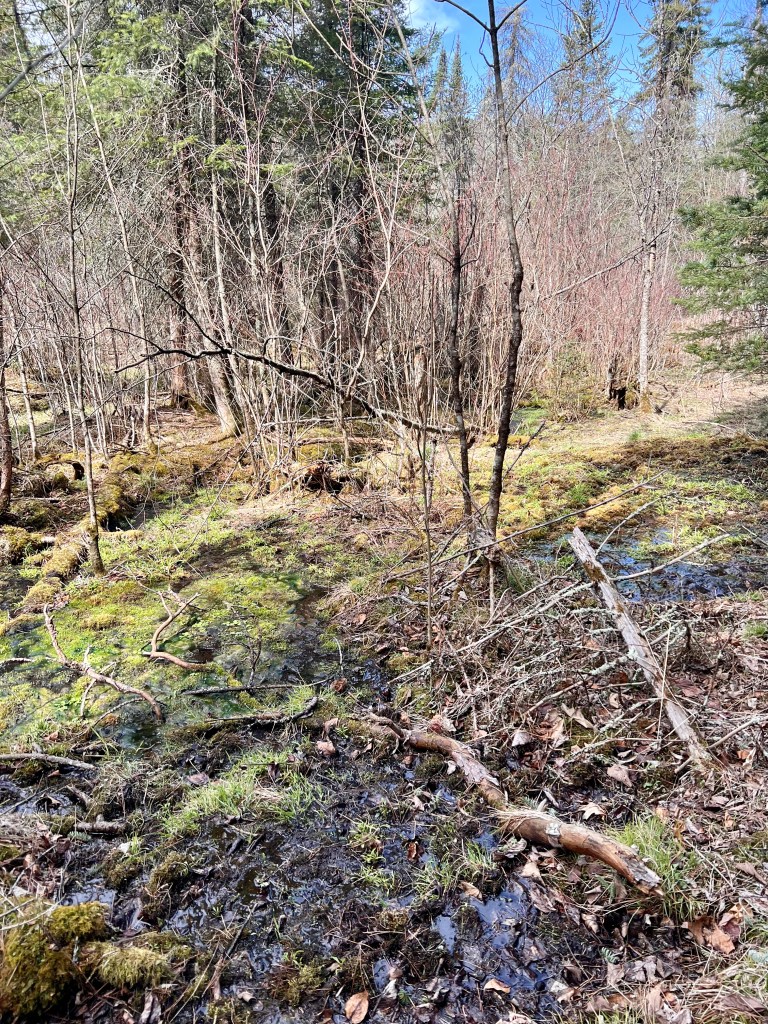
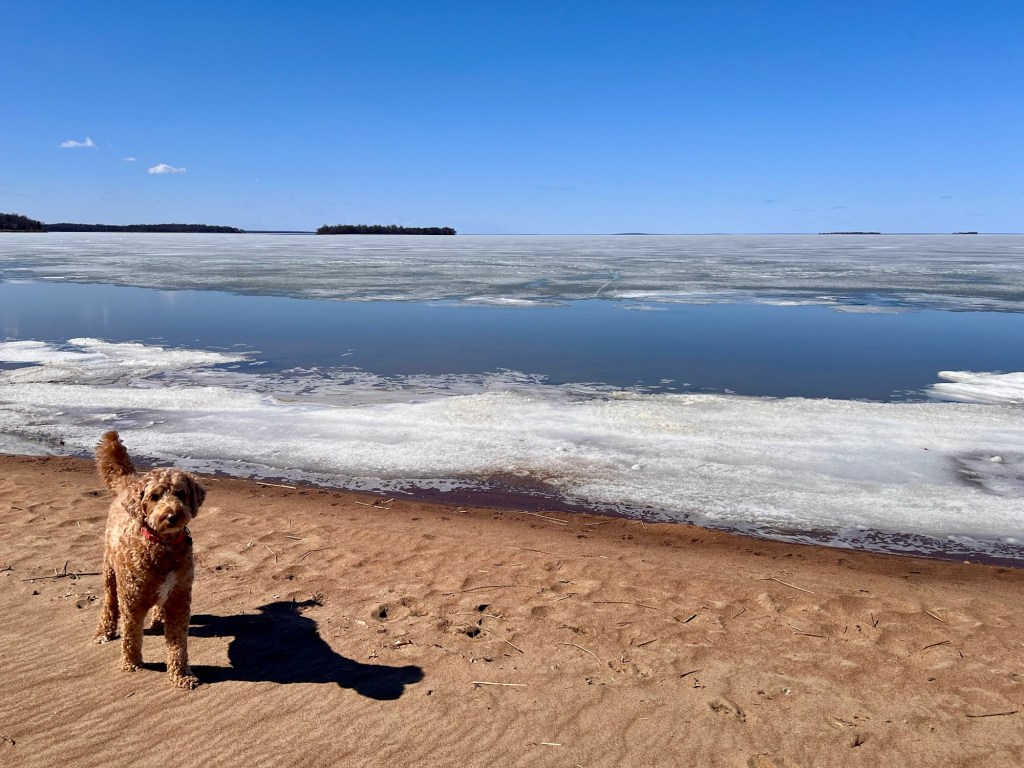
While not the officially designated headwaters, that little stream — today named Nicollet Creek — is curiously marked on Google Maps as the “Start of the Mississippi”. On Monday, our first full day in Itasca State Park, Spence and I hiked towards this point on the map. I wrote in my journal later that day:
This was the most beautiful and peaceful moment of the morning. The trail led us to the east side of Nicollet Lake. The wind in the tall pines sounded like waves crashing on a beach. No people, only the occasional squirrel or grouse. I realized I wouldn’t get to the point on my map by staying on the trail, so we ventured off in what I hoped was the right direction. After much scrambling over hills and through dense underbrush, we found a little creek trickling into Nicollet Lake. Is this you, Mississippi? It seems as good a spot as any to start a river.
I wondered if this little moss-covered creek could really be the birthplace of the mighty Mississippi. But this begged a second, more philosophical question:
Does it make sense to think of rivers as having a single source?
I remember having a funny conversation with my maternal grandma Phyllis Smith when I was a boy. She was visiting our house in Syracuse, Indiana, and we were talking about family history. My grandma’s maiden name was Reiner, and I had said something to her like, “Well, I’m not really a Reiner. I’m a Rude.” And she questioned me on that. “Who are you more related to,” she asked, “Your mother or your father?”
That puzzled me. “Neither,” I replied. “I’m related to them equally.”
“Well then,” she said. “Who is your mother more related to — her mother or her father?”
Again, I had to admit that both branches were equal.
“So, why aren’t you just as much a Reiner as you are a Rude?”
She had me there.
And couldn’t the same be said of rivers and their sources? Isn’t the Mississippi’s source to be found in every lake and stream that comprises the watershed?
And thinking more broadly about the water trickling through Nicollet Creek on the southwest side of Lake Itasca, that water… it didn’t just appear there. That water may have flowed over from an underground aquifer or may have fallen as rain the day before. And maybe that rain started as clouds that formed in the North Pacific — an ocean, of course, fed by the rivers of British Columbia, Alaska, Russia and Japan. Those rivers, in turn, may have been fed by moisture picked up in the forests of Siberia and Inner Mongolia… and on and on it goes without end.
But, why do we like to imagine that rivers have a singular, ultimate source? I don’t know the answer to this question, but I think it must be hardwired into us. In cultures all over the world, rivers loom large in the collective imagination — they appear regularly in our dreams and myths as mysterious conduits and thresholds. They are routinely personified as gods or goddesses. Tracing rivers back to their sources leads us to unimaginable realms because they are power incarnate. They are made up of the very thing that gives us life and, on occasion, takes it away — water.

Danu – mother of the Celtic gods; goddess of the Danube 
Haebek – Korean god of the Amnok River 
Ganga – Hindu goddess of the Ganges 
The goddess Yemonja — originally a goddess of the Ogun River in Nigeria — plays an important role in the Yoruba religion (image source here) As explained in Mni Sota Makoce: The Land of the Dakota, “In the beginning, the water—Mni—was pure, part of the land, and therefore part of the people. It was the first medicine given to our people because water keeps everything alive. Water that comes from within the earth is pure and as such is considered wakan or sacred.”3
In New Mexico, the Taos Pueblo people locate the source of the Rio Pueblo de Taos and all creation itself in the mystical Blue Lake (Ba Whyea).4 In the Irish tradition, the River Shannon and six other rivers originate from Connla’s Well, the Well of Wisdom.5 Similarly, the Norse believed that all major rivers trace back to Hvergelmir. This was the primal spring of Niflheim, sitting below one of the roots of Yggdrasil, the World Tree.6
Collectively, these stories point us toward the idea that the river — like life itself — derives its power from an ultimate and unknowable Mystery.
* * *
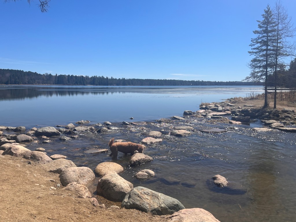
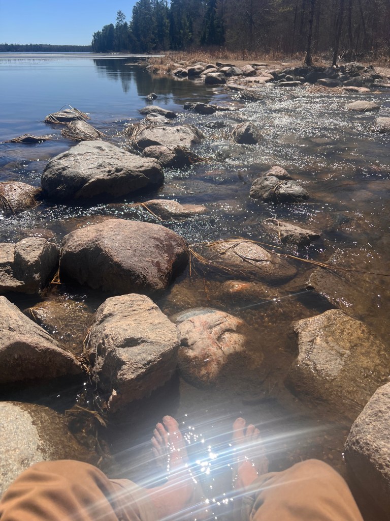
If Spence had opinions on any of the above, he didn’t share them with me. But after our second full day of hiking in Itasca State Park, he got warm and decided to have a soak in the lake. Unfortunately, he picked a muddy spot to do this. So, when we were heading out of the park, I drove us back to the officially designated headwaters site to wash him off. We had visited this spot the prior day, but now it was transformed. What had been a cold, windy and rather gloomy place was, on this afternoon, bathed in warm sunlight.
As there were no other visitors, I took Spence off the leash for a few minutes and let him splash around on the rocks where the Mississippi has its official start. He looked so happy that I decided I’d better take off my boots and put my toes in that icy water, too. As usual, Spence had the right idea.
- See https://en.wikipedia.org/wiki/River_source ↩︎
- See https://mississippivalleytraveler.com/searching-for-the-headwaters-of-the-mississippi-river/ ↩︎
- Westerman, Gwen and Bruce White (2012). Mni Sota Makoce: The Land of the Dakota. The Minnesota Historical Society. ↩︎
- Greely, June-Ann. (2017). “Water in Native American Spirituality: Liquid Life — Blood of the Earth and Life of the Community.” Green Humanities, vol. 2, pp. 156-179. ↩︎
- Gwynn, Edward, ed. (1913), “The Metrical Dindshenchas Part 3”, Royal Irish Academy Todd Lecture Series, vol. X, The University Press. ↩︎
- See https://www.britannica.com/topic/Niflheim#ref202774 ↩︎
-
The search for the source (part 1)
The Mississippi River system covers most of the American interior. Its many tributaries fan out like the branches of an enormous tree across the Midwest and Great Plains, stretching from the Appalachian Mountains in the East to the Rockies in the West. The river system remains critical to American shipping and commerce, and its historical importance to Europeans in their quest for control of the continent’s interior can’t be overstated.
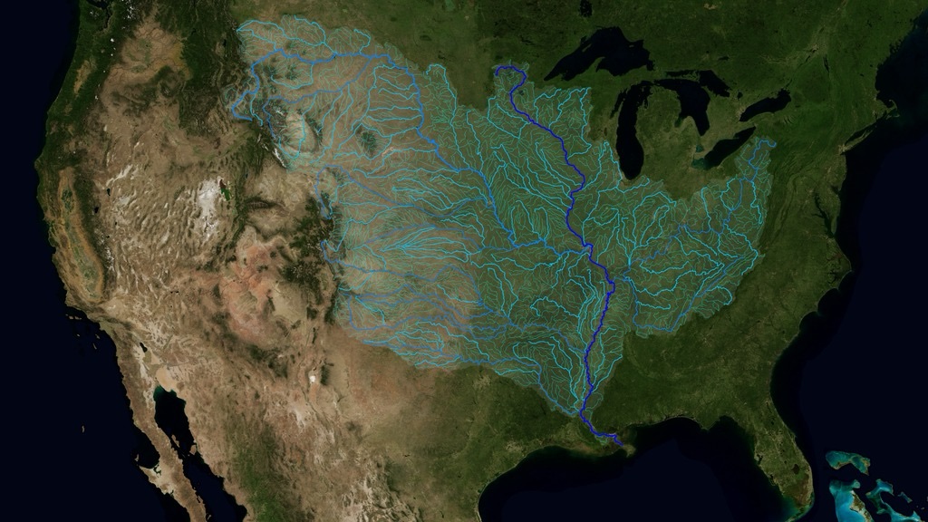
The Mississippi watershed (source: NASA’s Scientific Visualization Studio) This past week, my trusty travel companion Spence and I made the journey to the Mississippi headwaters in northern Minnesota. Granted, this wasn’t a particularly intrepid mission — I drove and brought the trappings of civilization with me. But it was still an adventure. And it prompted me to ponder the significance and sublime nature of this mighty river.
Part 1 — A Little History
Anyone with some knowledge of colonial history might assume that Europeans first explored the Mississippi from the river’s delta at the Gulf of Mexico. After all, the Spanish set up colonies in and around the Gulf during the late 15th and early 16th centuries (Santo Domingo, San Juan, Cuba…). And other rivers around the globe (the Congo, the Nile, the Amazon…) were first explored by Europeans from where their waters meet the sea. Not so with the Mississippi. It was encountered by Europeans from the middle.
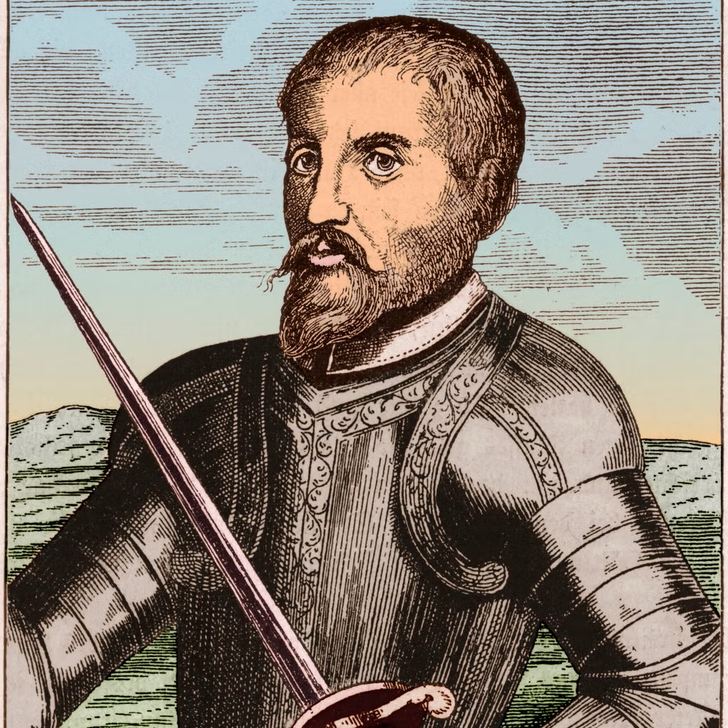
Hernando de Soto (image downloaded from this link) First came the Spanish conquistador Hernando de Soto, bushwhacking his way from Florida through what was later to become the American South. He reached the Mississippi on May 8, 1541, somewhere south of where Memphis stands today.[1] De Soto was on a quest for gold, and in that quest he failed miserably. Instead, he “discovered” the Mississippi. Those quotation marks are significant here, as of course Native Americans had traversed every inch of the great river, and over centuries they utilized its waterways to build vast networks of diplomacy and trade. A thousand years ago, these networks radiated out from the once populous city of Cahokia, near where St. Louis sits today.
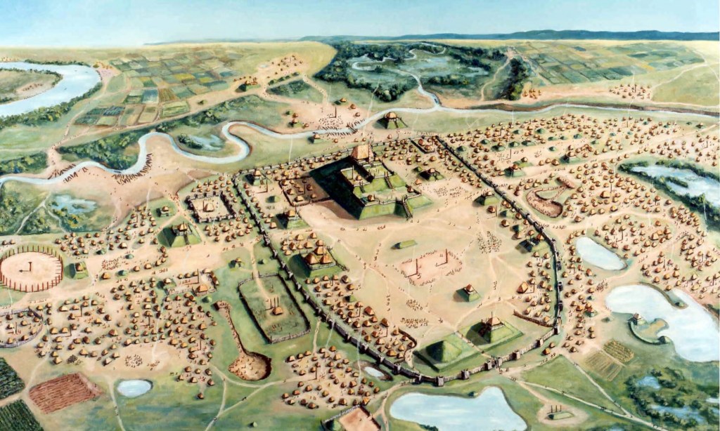
Illustration of Cahokia from the Cahokia Mounds State Historic Site (image downloaded from this link) De Soto never made it back to report on his findings. He died of a fever, somewhere in the wilds of what is now Louisiana or Arkansas. But don’t feel too sorry for de Soto. He made few friends on his mission. He and his soldiers massacred whole villages of natives, took slaves, and waged one of most brutal battles on American soil — one in which over 200 Spaniards and between 2,000 and 6,000 Native Americans died.[2]
France’s North American claims in the 16th – 18th centuries (map downloaded from this link) The French also first acquainted themselves with the Mississippi from the middle, but they did so with a different aim than the Spanish. Their goal in the interior was not so much conquest or even settlement per se; it was trade (and to a lesser degree, missionary work). In the mid-17th century, they sent explorers out from their bases in New France (i.e., Montréal and Québec City) to map the Great Lakes and establish trading posts in the Pay d’en Haut (high country). Like other European power players of that time, they hoped to find an easier route to Asia, as well as exploit the wealth of this mysterious continent. And they soon realized that one of its key sources of wealth was fur. The rugged purveyors of the fur trade, the voyageurs as they were known, worked hard to learn Native ways of surviving in the wild. In many cases they picked up Native languages and intermarried with Native families, and the descendants of these marriages occupied a “middle ground” between French and Native cultures.[3]
Unknown fur trader of French and Native ancestry (photo downloaded from this link) 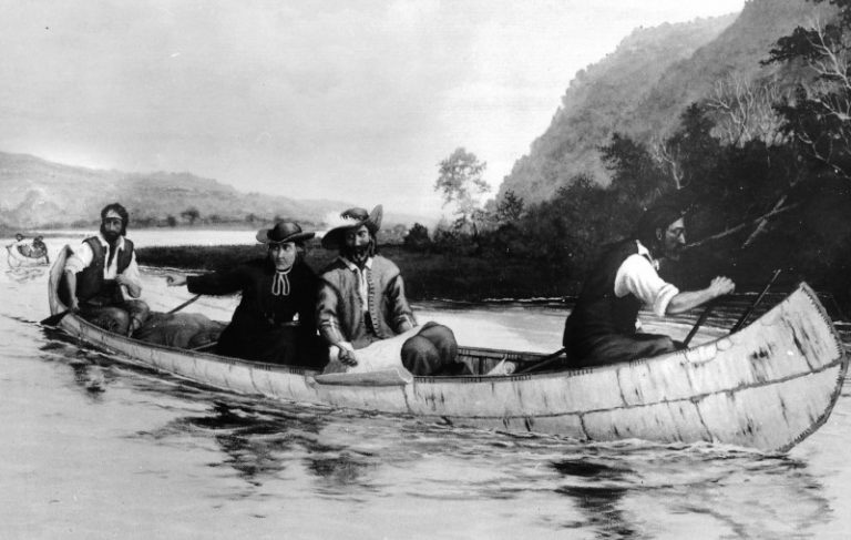
A modern interpretation of Marquette and Jolliet reaching the Mississippi (downloaded from this blog) The first French explorers to reach the Mississippi were fur trader Louis Jolliet and Jesuit father Jacques Marquette. In 1673, they canoed to Green Bay and then upstream the Fox River to the point where the Wisconsin River can be reached via a mile-and-a-half portage (location of Portage, Wisconsin today). From here they paddled down the Wisconsin to where it meets the Mississippi, entering the river on June 17 of that year. They traveled the Mississippi as far south as the Arkansas River, but then concluding it led to the Gulf not the Pacific, they headed back. They returned to Lake Michigan via the Illinois River and a portage to the Chicago River. Later that decade, René-Robert Cavelier, Sieur de la Salle would be commissioned to explore the Mississippi more fully. La Salle took Jolliet and Marquette’s route through Illinois and traveled down the length of the Mississippi to its mouth. Here in 1682 he declared the river’s entire drainage basin for France, not knowing of course how vast those lands were. He named it Louisiane, in honor of his king.[4]
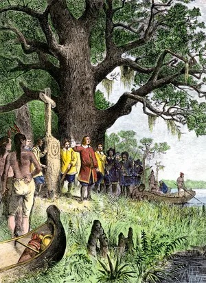
La Salle laying claim to the Mississippi basin (image source here) 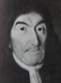
Father Hennepin — Franciscan friar and occasional liar (image source here) Before heading south from Illinois, La Salle sent three of his men north to search for the river’s headwaters: two voyageurs (Michel Accault and Antoine Auguelle) and a Franciscan priest named Louis Hennepin. On their journey, the men were taken captive by Dakota warriors, who decided to bring them to their home village of Izatys on what is now Lake Mille Lacs in central Minnesota. In the process, the three Europeans traveled the Upper Mississippi to where St. Paul sits today and journeyed overland from there to Izatys. While staying with the Dakota, Hennepin convinced his captors to let him and Auguelle explore the region. Accault stayed behind (perhaps as a hostage?), while Hennepin and Auguelle paddled down the Rum River to the Mississippi. They picked up additional supplies near the junction of the Mississippi and Wisconsin rivers (Prairie du Chien), and it was during this trip they encountered the only significant waterfalls along the river. Hennepin named the falls after his patron saint, St. Anthony, and they became the future site of Minneapolis.[5]
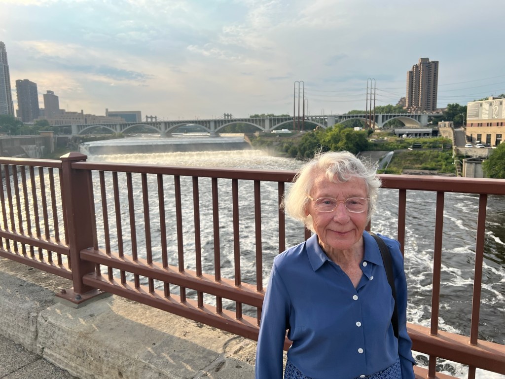
My mother-in-law in front of St. Anthony Falls, Minneapolis (summer of 2025) 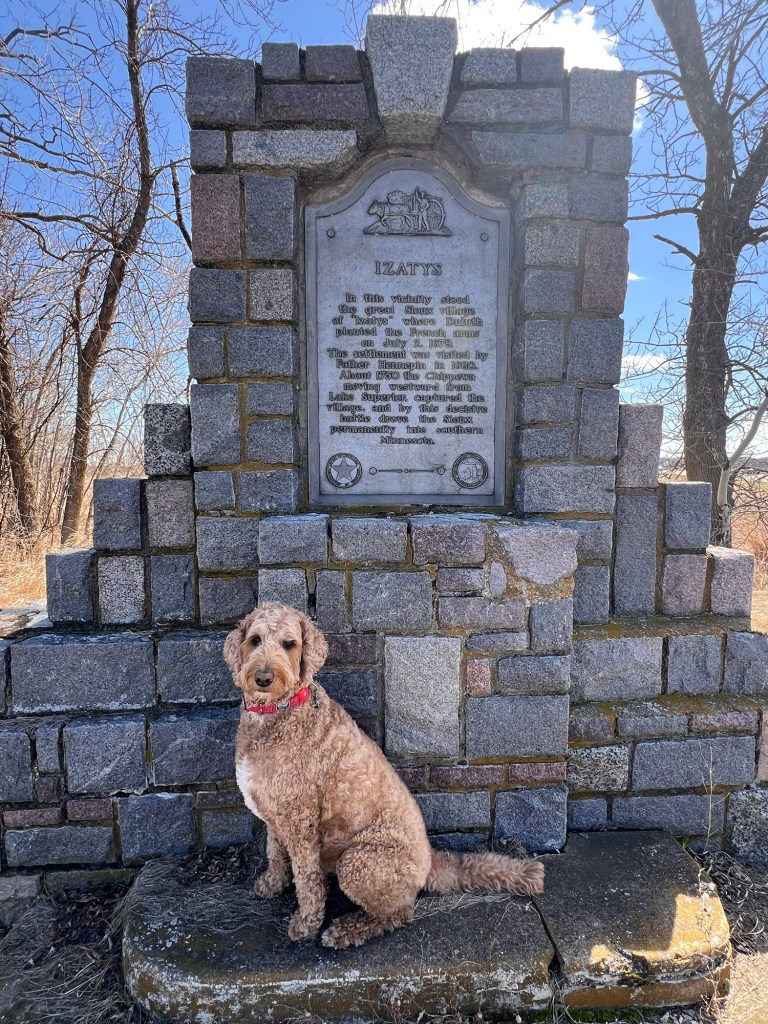
Spence visits the location of the Dakota village Izatys (Mille Lacs, Minnesota) Within 125 years of this expedition, the Mississippi basin would change hands several times (at least on paper). In 1763, when the French lost the Seven Years War, their lands east of the river were ceded to Britain and their lands west of the river were ceded to Spain (in compensation for Britain taking Florida). The newest international player, the United States, would take up Britain’s claims in 1783 and push westward to the Mississippi, encroaching on Spanish Louisiana. At the turn of the 19th century, Spain ceded its claims back to France in the hope of having a buffer between New Spain and their obnoxious new neighbor. But in 1803, three weeks after the administration of Louisiana was officially handed back to France, France sold its claims — to that obnoxious new neighbor!
At the time the U.S. assumed possession of both banks of the Mississippi, the river’s drainage basin had never been clearly defined, and no one was entirely sure where the river originated. In 1804, President Jefferson sent Meriwether Louis and William Clark on mission to explore its largest western tributary, the Missouri River, and the next year Zebulon Pike was sent north to explore the headwaters.
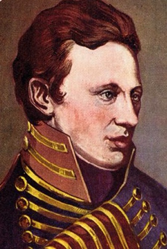
Zebulon Pike, brash upstart lieutenant for a brash upstart nation (image source here) If you’ve read my earlier blog post about the confluence of the Minnesota and Mississippi rivers, then you’ve met Pike before. The bold young lieutenant negotiated with the Dakota to purchase two tracts of land in what would become Minnesota, and then he and his men headed north to harass British fur traders and find the Mississippi headwaters. After some poking around, Pike declared Leech Lake to be the river’s source.
Spence investigates the icy waters of Leech Lake, which he declares not to be the source of the Mississippi (not even close). But Pike was wrong, and in 1820 the territorial governor, Lewis Cass, set out on an expedition to clear things up. When the group reached Sandy Lake, Cass stayed behind and directed a detachment up the Mississippi. This smaller party found a good-sized lake, which they reported to Cass to be the source of the river. They named it Cass Lake. That party included mineralogist Henry R. Schoolcraft, who privately wasn’t too sure about the group’s conclusion. He noted in his journal that other streams appeared to feed Cass Lake, and this fact haunted him.[6]
Henry R. Schoolcraft, a mineralogist with an axe to grind (image source here) 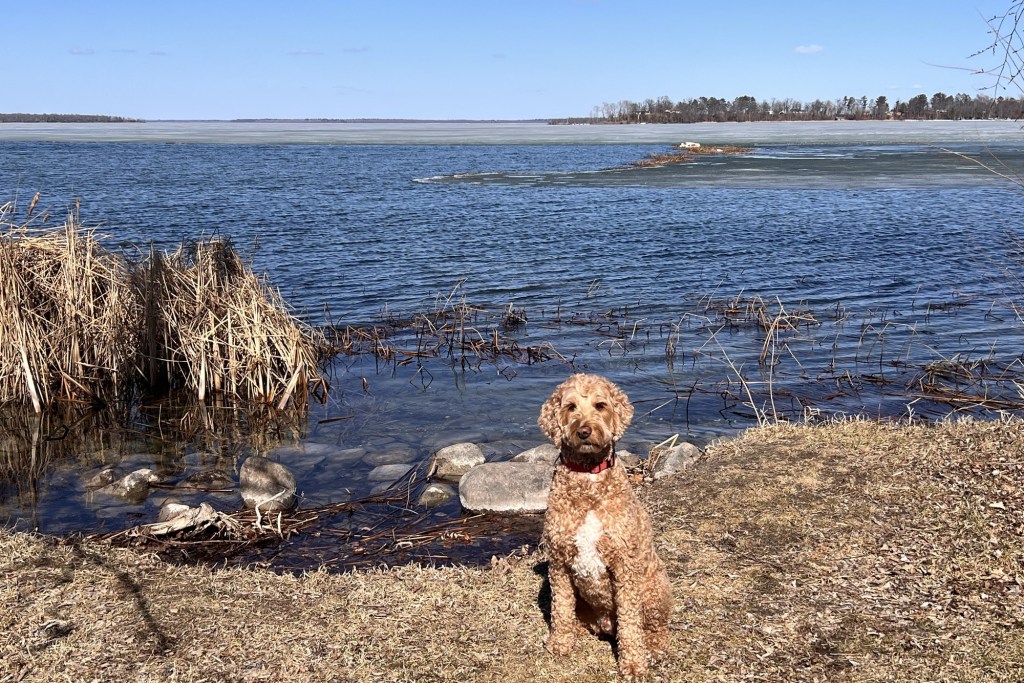
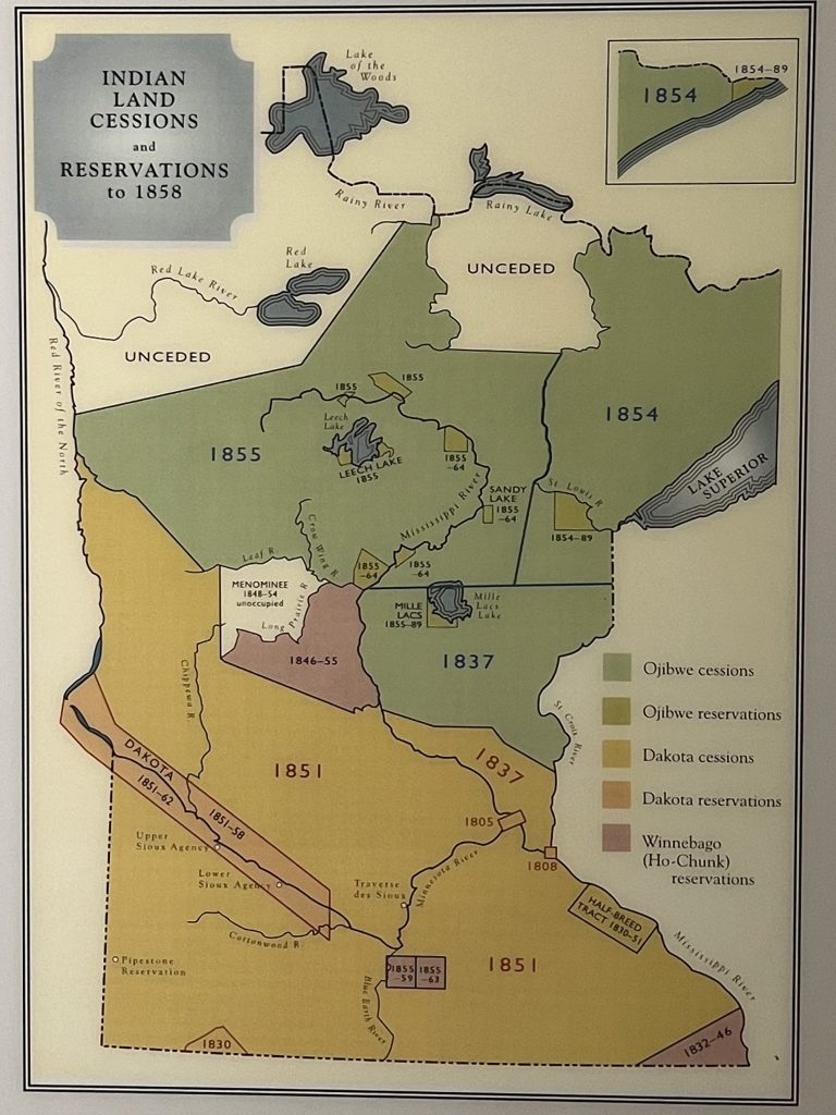
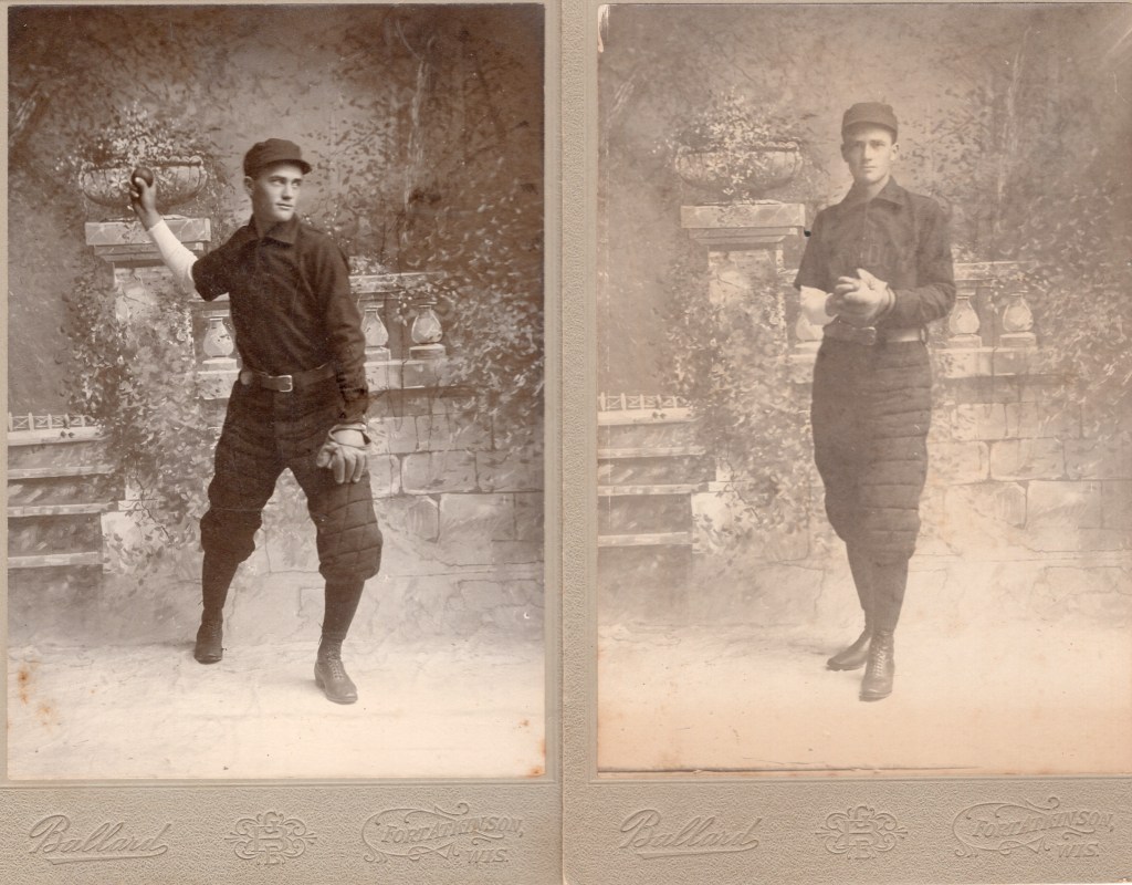
Spence agrees that Cass Lake, while pretty, is not the source of the Mississippi. Twelve years later, Schoolcraft — then the Indian agent at Sault Ste. Marie — sought funding for another expedition in the region. He wrote to his old friend Cass, who was then the Secretary of War. His stated mission had nothing to do with the Mississippi headwaters, but that’s exactly what he focused on when he reached Minnesota in 1832. Recruiting the help of an Ojibwe guide named Ozawindib, Schoolcraft and his group traced the main feeder stream from Cass Lake through various twists and turns. Eventually, at the end of a long chain of lakes and streams, they arrived at a body of water the Ojibwe called Omushkos (Elk Lake). As this was the true head of the Mississippi, Schoolcraft wanted to give it a grander name. He asked Rev. Boutwell, the expedition’s minister, for suggestions rooted in the classics, “but all the poor man could think of were the Latin words for ‘true head’ — veritas and caput. From that Schoolcraft fashioned a name that was both classical in origin and Indianlike in sound. He struck out the first syllable in veritas and the last syllable of caput and announced that the name… would be ‘Lake Itasca’.”[7]
Lake Itasca at the point where the Mississippi flows out After Schoolcraft’s expedition there were several others who would claim to have found the “true source” – typically one of the little creeks flowing into Itasca. A kerfuffle ensued and was not fully resolved until 1888. This is when the Minnesota Historical Society stepped in and authorized Jacob V. Brower to settle the matter. Brower determined those other little creeks didn’t warrant river status, and thus Itasca retained its title.
Over a couple days this past week, Spence and I conducted our own investigation into the source of the Mississippi. I shall report back our findings in my next installment. Stay tuned for Part 2!
[1] See pp. 115-116 in Fremling, Calvin R. (2005). Immortal River: The Upper Mississippi in Ancient and Modern Times. The University of Wisconsin Press.
[2] See https://www.nps.gov/liri/learn/historyculture/de-soto-expedition-1539-1542.htm
[3] White, Richard. (1991). The Middle Ground: Indians, empires, and republics in the Great Lakes region, 1650-1815. Cambridge University Press.
[4] See pp. 118-120 in in Fremling, Calvin R. (2005). Immortal River: The Upper Mississippi in Ancient and Modern Times. The University of Wisconsin Press.
[5] The release of the three men was negotiated by Daniel Greysolon, Sieur du Lhut (Duluth), who had been on his own expedition from Lake Superior. After his time in the wilderness, Hennepin sailed back to France and wrote three books about his adventures, taking some serious liberties with the truth. In one book he claimed to have discovered the mouth of the Mississippi before La Salle — a feat not physically possible. La Salle, meanwhile, also returned to France to secure more funding. He proposed founding a colony at the Mississippi’s mouth and capturing parts New Spain (i.e., Mexico). The king liked the sound of that, and so La Salle sailed off to the Gulf. The mission was doomed, however. They miscalculated the location of the river’s mouth by hundreds of miles and ended up in a bay near present-day Victoria, Texas. Within a couple years, their ships had sunk, most of the colonists had died or had been captured by Native tribes, and La Salle was himself murdered by one of his own men (see Fremling, p. 120).
[6] See pp. 41-49 in Risjord, Norman K. (2005). A Popular History of Minnesota. Minnesota Historical Society Press.
[7] See Risjord, p. 49.
-
Notes from the heartland (Part 5: Home)

I am home now after my road trip, a road trip long enough to permit some reflection. If you’ve read my previous posts, you won’t be surprised that I’ve been reflecting on our place in history. We Americans are living in a challenging time right now in terms of historical storytelling. Challenging but not unprecedented. In the 1950s, during the Red Scare, Americans who dared point out inconvenient truths about the nation’s historical inequities were labeled socialists, communists, or un-American. Today the ruling faction in Washington and in many states has decided that certain stories about America’s past shouldn’t be told, at least not in their entirety. Historical markers, national museums, and chapters of school textbooks are being revised in the belief that if such stories are fully told, young Americans will grow up hating their country.
I have a different view. Mine is that if young Americans don’t have a clear sense of how events unfolded, they’ll grow up loving an image of their nation that doesn’t match reality. They won’t actually have an opportunity to fall in love with America, only a whitewashed or romanticized version of it. I believe, moreover, that without sharing the breadth of our collective experiences — even those experiences that are uncomfortable or contradict our stated values — our history doesn’t make much sense. And if we can’t make sense of our past, what hope do we have of transcending it?
One such contradiction was embedded in the nation’s fabric from day one and it’s with us today. This contradiction is painfully obvious to anyone who knows their history, and I was constantly reminded of it during my travels through the heartland. I’m not breaking any new ground by pointing it out, but it does run counter to the sanitized narratives that America’s right-wing would have us parrot (e.g., the rewriting of the Wounded Knee Massacre).
The “land of the free” was carved out of other people’s land, people who were systematically excluded from it.
Once we come to grips with the totality of that contradiction, it’s hard to look at America in the same way. Over the past week, I’ve been writing about my American settler roots, and it’s quite possible (as I have done in the last few posts) to write about frontiers, pioneers, and homesteaders, and cleanly skip over this contradiction.
Plat of Christiana Township (6 N, 12 E of the 4th Principal Meridian), Dane County, Wisconsin (1890), where several ancestors on both my mom and dad’s sides settled between 1849 and 1904 Settler-colonial geography is linear — millions upon millions of acres of neatly surveyed farm land, little squares as far as the eye can see. But this geography was superimposed upon the native geographies that preceded it. Additionally, native geographies from the east were transferred westward by various forms of forced migration. These different geographies interpenetrate one another in America’s heartland, and the history of native land dispossession can be found everywhere you care to look: it’s written into the names of towns and counties, written into forgotten roadside markers, written into the smattering of reservations that break up the settler grid.
My own understanding of these other histories, these other geographies is woefully inadequate. Somewhat belatedly I am trying to rectify that. What follows are a handful of photos and reflections from three stops along my route.
Oklahoma
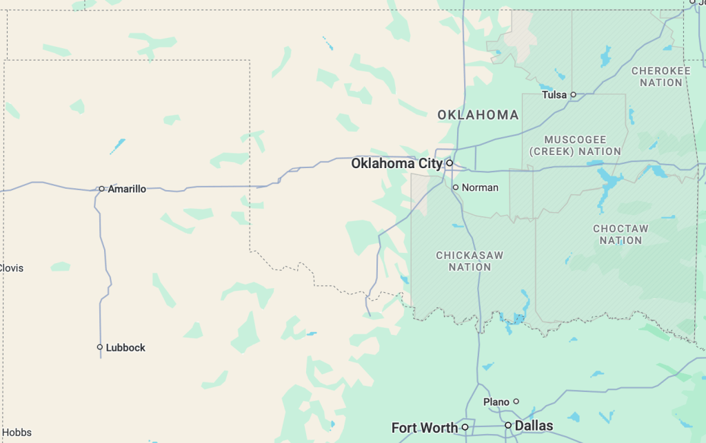
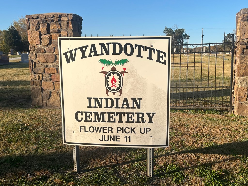
Driving to Texas and back afforded me two journeys through Oklahoma: one from the northeast corner heading southwest (via Tahlequah and Muskogee), and the other headed due north from Fort Worth (via Oklahoma City). In criss-crossing the state, I drove through at least seven reservations. The conglomeration of tribal authorities here is owed to the fact that much of what would become the state of Oklahoma was once “Indian Territory” — lands set aside by the U.S. Federal government for indigenous peoples after being forcibly removed from their homelands out East.
The core of Indian Territory was made up of land granted to what were then called the “Five Civilized Tribes” (Cherokee, Muscogee, Seminole, Choctaw, and Chickasaw) after their dispossession and forced march across the South in the 1830s and 40s — the infamous Trail of Tears. But even this set-aside territory was whittled away by the federal government in the post-Civil War era. Factions of the Five Tribes had sided with the Confederacy, and the Union took a heavy-handed approach to dealings with them after the War. Nationally this was a period in which native children were sent away to boarding schools in order to “civilize” them, and white settler-colonists squatted on native lands with impunity. The federal government also resettled many Eastern tribes on lands belonging to the Five Tribes during this time.
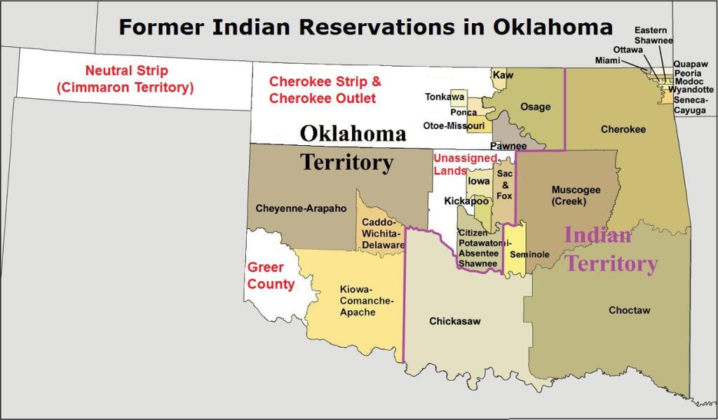
Map by Kmusser – File:Okterritory.png, CC BY-SA 3.0, Link The Dawes Act of 1887 codified the federal government’s assimilationist approach to Native America — communal native lands were to be converted into individual landholdings. This paved the way for the carving of Oklahoma Territory out of Indian Territory in 1890, and eventually — after a failed bid to form the native State of Sequoyah — for the creation of the State of Oklahoma in 1907. The settler grid had been imposed on Indian Territory. (For a more nuanced explanation of all of the above, I highly recommend Ned Blackhawk’s excellent history, published in 2023, The Rediscovery of America: Native Peoples and the Unmaking of U.S. History. See especially Chapter 9, “Collapse and Total War: The Indigenous West and the U.S. Civil War”.)
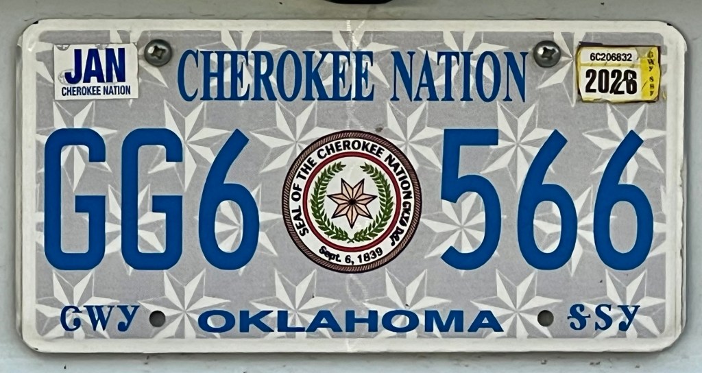

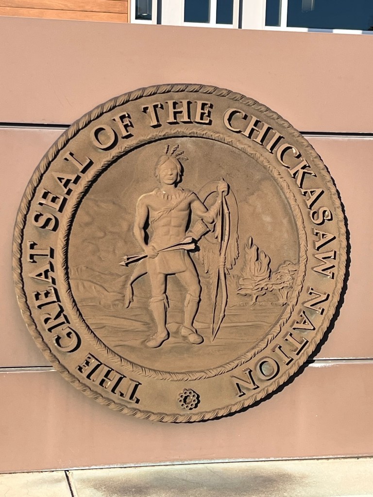


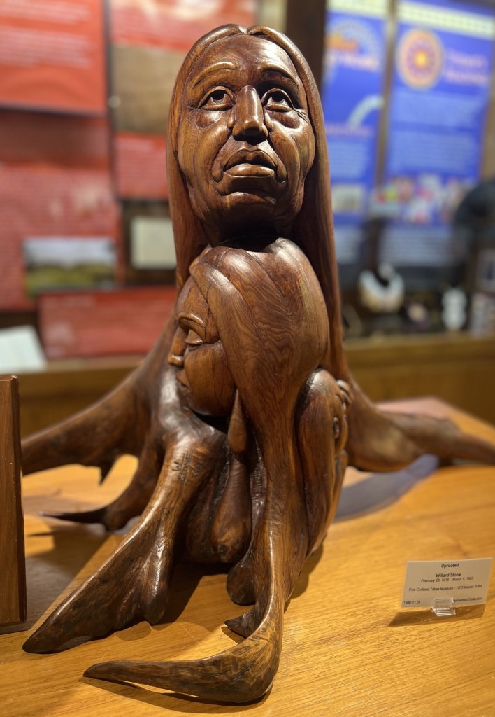
Cherokee National History Museum; Tahlequah, OK (Cherokee Nation) 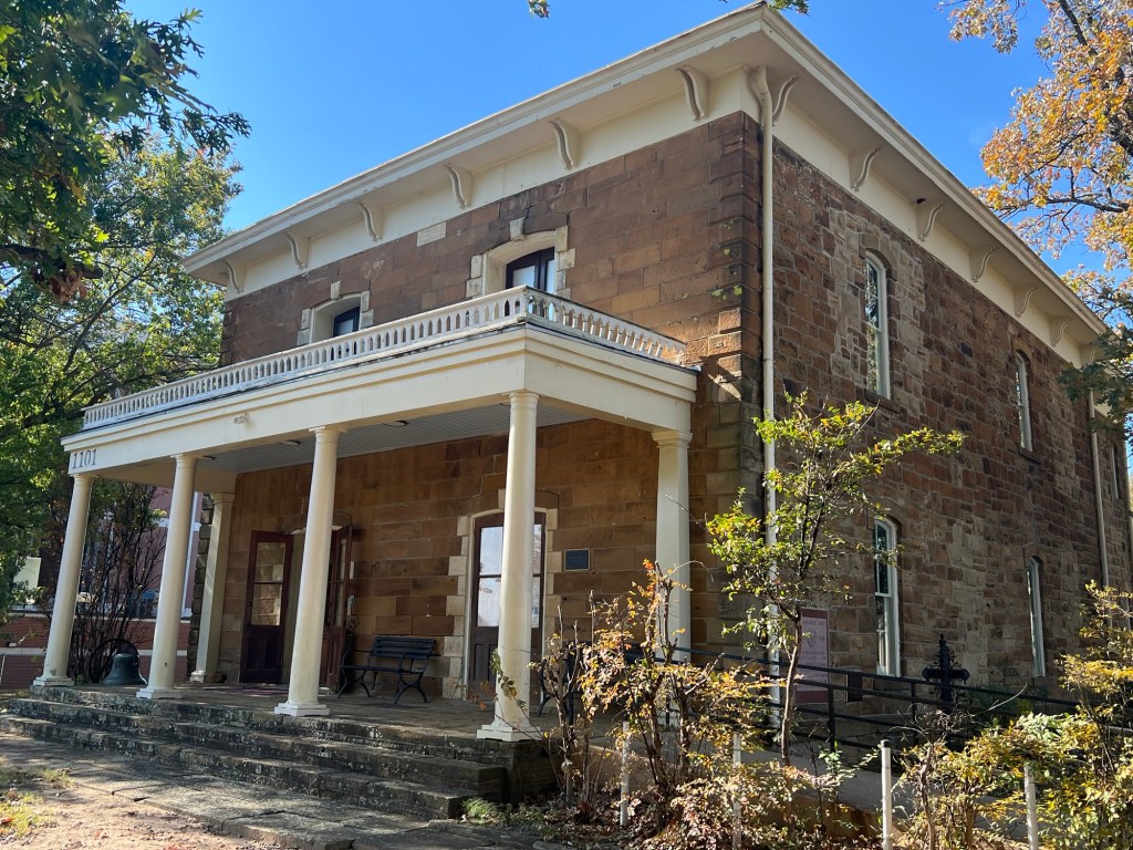

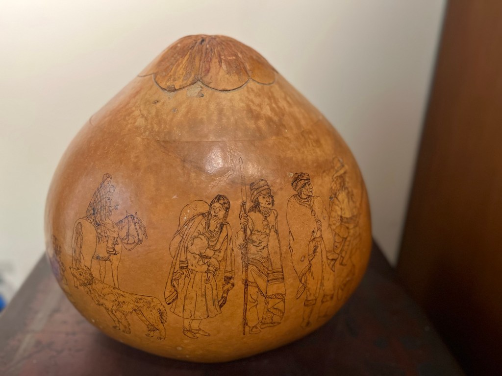
Five Civilized Tribes Museum, Muskogee, OK (Muscogee/Creek Nation) Winnebago Reservation, Nebraska
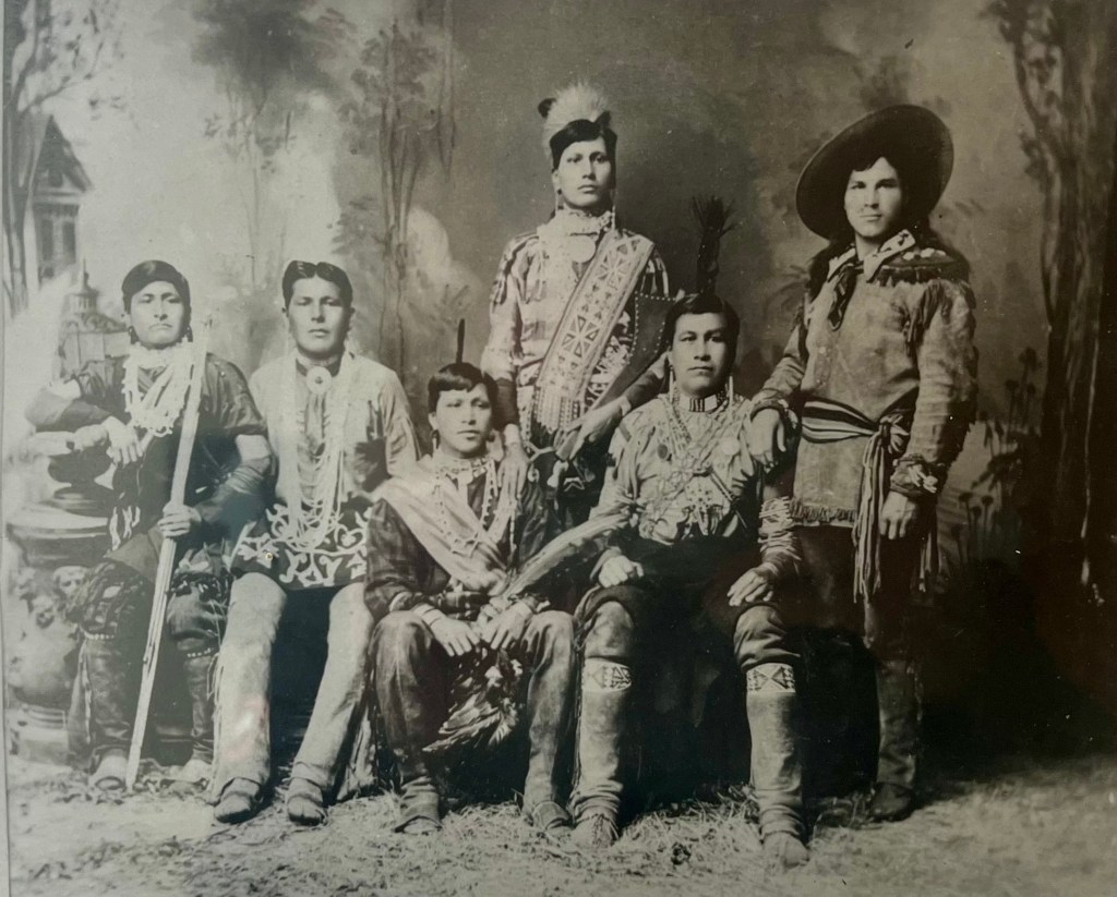
Photo of unnamed Wisconsin Ho-Chunk men, Angel De Cora Museum & Research Center, Winnebago, NE (Winnebago Tribe of Nebraska) Yesterday I drove through lands belonging to the Winnebago Tribe of Nebraska. Until the colonial period, the Winnebago — also known as the Ho-Chunk — controlled much of southern Wisconsin where my ancestors settled in the mid- and late-19th century. During the 17th and 18th centuries, Ho-Chunk numbers were greatly reduced by disease and by warfare with tribes that had been pushed into their territory due to conflict and colonization in the East.
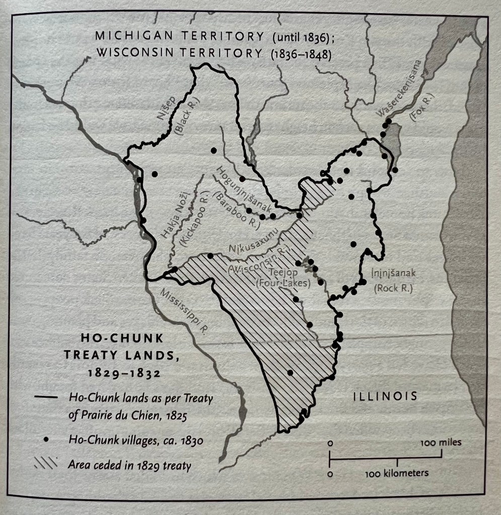
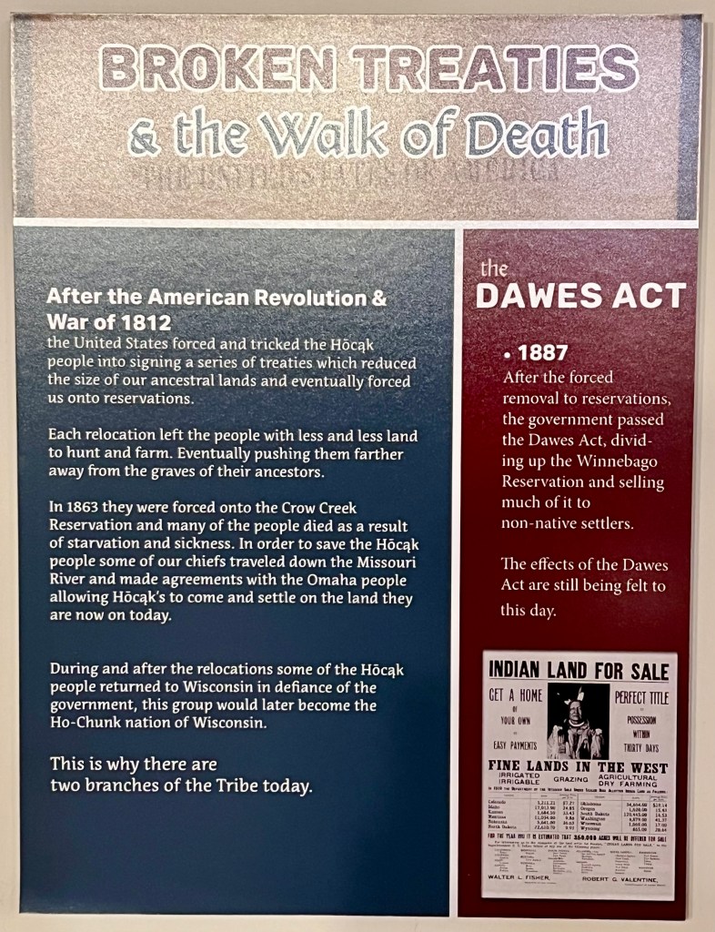
Map from p. 27 of Kantrowitz’s (2023) Citizens of a Stolen Land But theirs is a story of great resilience despite a concerted effort on the part of white settlers to sweep them aside. Through a series of unequal treaties, all federally recognized Ho-Chunk lands in Wisconsin were eventually ceded, and the Ho-Chunk were forcibly relocated to a reservation in Iowa in the 1830s. But local white settlers objected to the Ho-Chunk presence and they were again forcibly removed, this time to Long Prairie, Minnesota. The Ho-Chunk were dissatisfied with Long Prairie, and they negotiated a move to Blue Earth, Minnesota, where the topography was more similar to their homelands. After the Dakota War (see next section), the Ho-Chunk were accused of disloyalty, despite not having participated in the conflict. They were exiled to Crow Creek, South Dakota, a dry and desolate camp along the Missouri. Faced with starvation, the Ho-Chunk leadership negotiated with the Omaha people to secure the current reservation in Nebraska.
Each of those forced moves, like the Trail of Tears, disrupted the lives and livelihoods of the Ho-Chunk people and many didn’t survive. The Ho-Chunk refer to these involuntary relocations as the Walk of Death. In spite of the terrible conditions, a group of tribe members persisted, surviving to form the Winnebago Tribe that exists in Nebraska today.

Display at the Angel De Cora Museum & Research Center, Winnebago, NE (Winnebago Tribe of Nebraska) Furthermore, at each stage in this long history of dispossession, there were Ho-Chunk people who nonviolently resisted. Some individuals and families secretly remained in or traveled back to Wisconsin. Some even managed to take advantage of the Homestead Act to become landowners on their ancestral lands. It’s for this reason that a second federally recognized Ho-Chunk tribe exists, headquartered in Black River Falls, Wisconsin, despite not having a reservation in the state.
Display at the Angel De Cora Museum & Research Center, Winnebago, NE (Winnebago Tribe of Nebraska) Yesterday I had the opportunity to get to know this history a little at the Angel De Cora Museum in Winnebago, Nebraska. The Winnebago Tribe of Nebraska also provides a brief history of their people at this link. For a detailed account of how the Ho-Chunk people managed to survive the various trials of the 19th century, I highly recommend Stephen Kantrowitz’s (2023) Citizens of a Stolen Land: A Ho-Chunk History of the Nineteenth-Century United States.
Visiting the Winnebago Reservation, I was struck by the irony that my ancestors who had attempted to settle a few miles away (see this post) had been able to pack up and head “home” to Wisconsin when their crops failed. Most Ho-Chunk, however, did not have this luxury.

Angel De Cora Museum & Research Center, Winnebago, NE (Winnebago Tribe of Nebraska) 
The museum melds contemporary expressions of Ho-Chunk life and culture with historical accounts, emphasizing the continuity and persistence of the Ho-Chunk people Mankato, Minnesota
A couple months ago, I wrote a little about the Dakota War of 1862 and the imprisonment of the Dakota people at Fort Snelling in the wake of the conflict (see this post). The Dakota people are indigenous to large parts of what is now Minnesota and western Wisconsin. After the uprising, the Dakotas were stripped of their lands in Minnesota and exiled to Nebraska, North and South Dakota, and Canada. This was contrary to multiple treaties signed by the Dakota tribes and the U.S. government, which had promised the Dakotas land in Minnesota and economic assistance — in the end, they got neither.
Display at the Treaty Site History Center, Traverse des Sioux (near St. Peter, MN) But to their credit, many Dakota people, similar to the Ho-Chunk, found ways back into their ancestral lands, and Minnesota is today home to four federally recognized Dakota tribes: the Shakopee Mdewakanton, Prairie Island Indian Community, Upper Sioux Community, and the Lower Sioux Indian Community.
I made a stop in Mankato today to visit the site where 38 Dakota men were publicly hanged in 1862 for their alleged involvement in the Dakota War. This was the largest mass execution in U.S. history. You feel the weight of history in a place like this, revisiting an episode from our past that we’re rarely taught. (For an excellent reflection on how this history has come to be remembered, I recommend this essay.)


Photos from Reconciliation Park, Mankato, MN History like this can be unsettling for Americans such as myself who are the descendants of the first white settlers in the Midwest. For me, fully seeing this history means coming face to face with the fact that my ancestors and I have been beneficiaries of “Indian removal” — policies and practices that were at best unfair and at worst genocidal.
But feeling unsettled isn’t always a bad thing. It can open us up to nuance, clarity, and insight. A deeper understanding of how Native America intersects with settler-colonial America doesn’t make me hate my ancestors. It expands my perspective of them beyond the two-dimensional pioneers we meet in old Westerns and Disney films. When we start seeing indigenous peoples and their histories as intimately connected with the histories of those who colonized America, we can imagine new possibilities for historical storytelling — possibilities that honor the complexity of the American past.
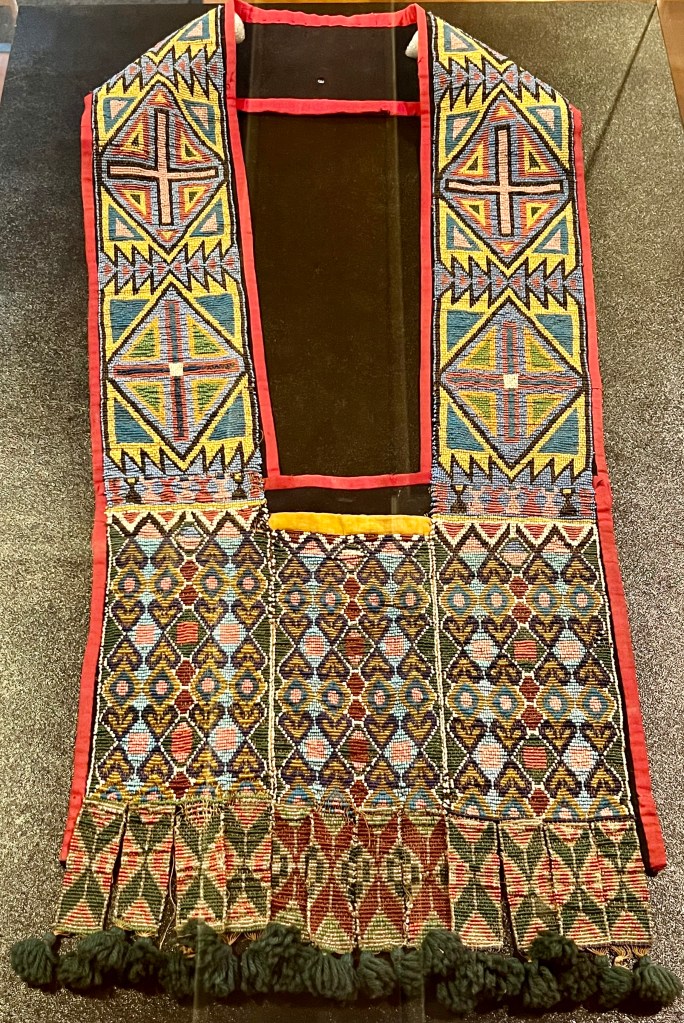
Rōksu hikixarac (bandolier bag), made in Wisconsin in the late 1800s with design influences from Scandinavian settlers (Angel De Cora Museum, Winnebago, NE) -
Notes from the heartland (Part 4: Nebraska)
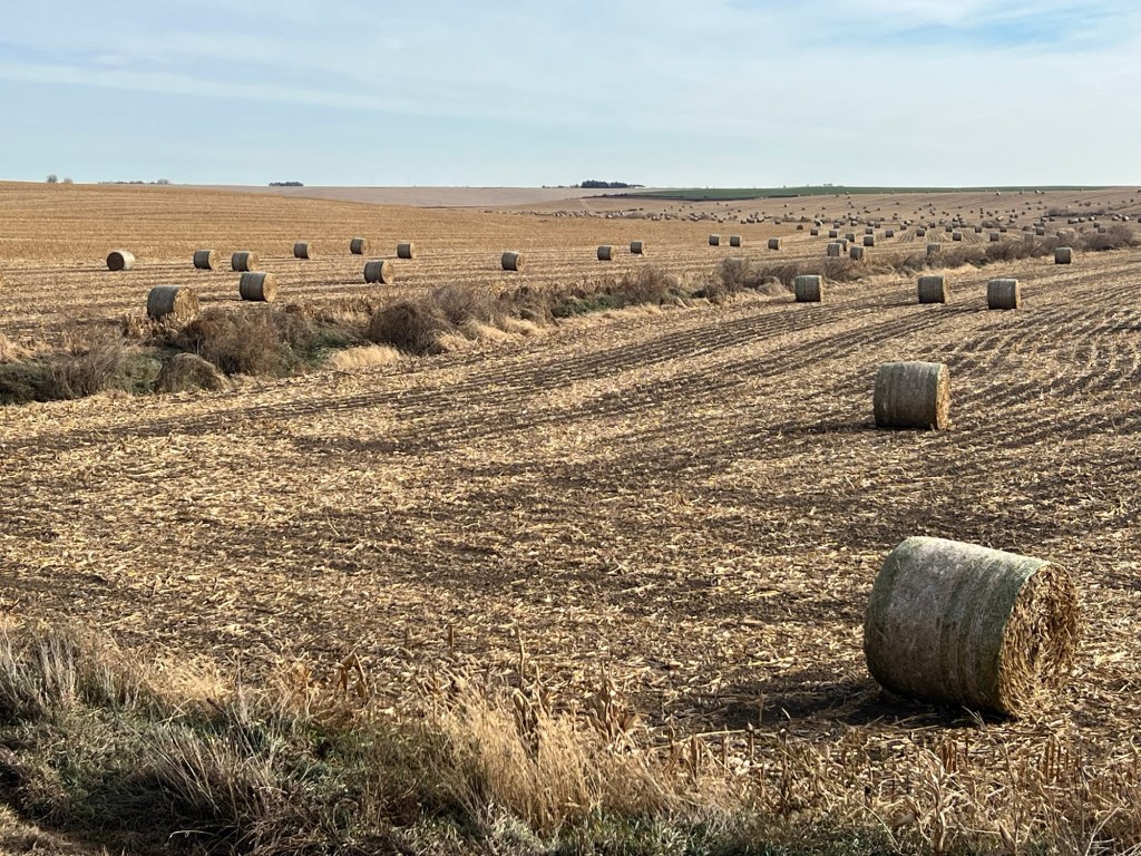
Starting out from Fort Worth yesterday, my canine companion and I traced the Chisholm Trail up to where it peters out near Salina, Kansas. From there we headed due north on a lonely stretch of US 81 into the endless plains of southern Nebraska. Between the Platte and Elkhorn rivers, the terrain changes to gently rolling hills. The farms are so large here that it can be hard to spot a building on the horizon. Post-harvest, these fields could almost be mistaken for sand dunes. Eventually we reached our destination, a tiny town called Wisner.
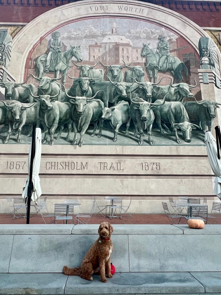
Round ‘em up, Spence! (Sundance Square, Fort Worth, TX) 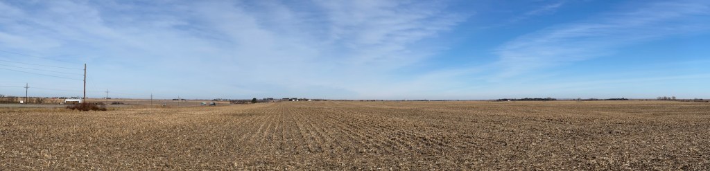
They don’t call it the Great Plains for nothing (Hebron, NE) 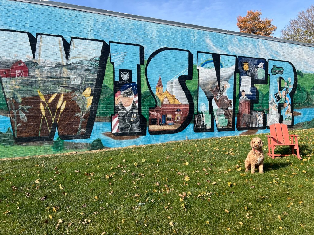
Photo op in Wisner, NE Walking along Wisner’s quiet streets, my dog Spence looks at me as if to ask, “Why are we here?” You may be wondering the same thing. To explain, I need to take you back to the early 1870s.
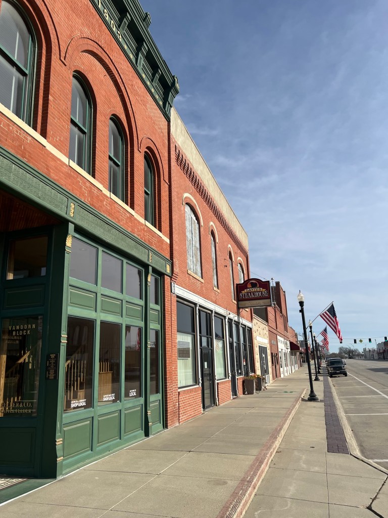
Downtown Wisner My great-great grandparents, Albert Jens Johnson and Julia (Guri) Anne Torbleau, were part of the first generation of my family to be born on American soil (see Chart B on this page). Albert’s parents had come to Deerfield, Wisconsin in 1850 (see this post) and Julia’s had come in 1849 (see this post) — both couples originating in small communities in Western Norway. Albert and Julia came of age in the aftermath of the U.S. Civil War, when America’s westward ambitions were reaching their zenith. Steeped in this culture of western expansion and growing up on their parents’ stories of forging a new life in a new land, is it any wonder that Albert and Julia dreamed of doing the same?
A family history written in the 1970s by Aunt Glenrose (Albert and Julia’s youngest child) records that Albert and Julia met at one of the socials or house parties put on each weekend by the community’s Norwegian residents. The 1870 Census shows Albert and Julia still living in their respective homes. Albert is 17 and listed as a carpenter’s apprentice. Julia is 15 and listed as “at home”, though Glenrose’s history states Julia worked in the household of Dr. Fox in her youth.
According to a newspaper article from the Newman Grove Reporter, a large group of Norwegians left Deerfield, Wisconsin for eastern Nebraska in 1872, traveling together in a convoy of prairie schooners.* They comprised “a train of ten wagons, seven horse teams and three ox teams, and arrived at Wisner, Nebraska on June 25, 1872.” The group included Ole E. Torgerson, a Lutheran pastor in the Haugean tradition, who “had great influence not only as a spiritual teacher but as a business man, advisor and promoter of the welfare of the pioneers…” I’m inclined to believe that Albert Johnson was among the pioneers who joined this wagon train.
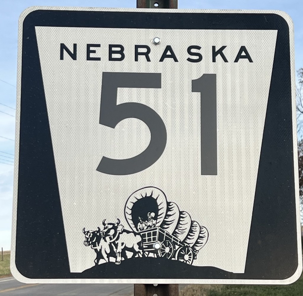
The state road signs in Nebraska feature a covered wagon Glenrose wrote that “[Albert] went to Wisner, Nebraska and worked as a carpenter. He built a house and wrote for my mother to join him.” They married soon after Julia arrived, on December 7, 1873, at the ages of 20 and 18, respectively. My guess is that Albert accompanied Rev. Torgerson and the others from Deerfield in 1872 and that Julia arrived the next year, perhaps via the newly built railway. Evidence linking Albert and Julia to the group of pioneers in the newspaper article is slim: it’s simply that the timing seems too perfect to be a coincidence, and the man who officiated Albert and Julia’s marriage in Wisner, Nebraska was none other than Ole E. Torgerson.**
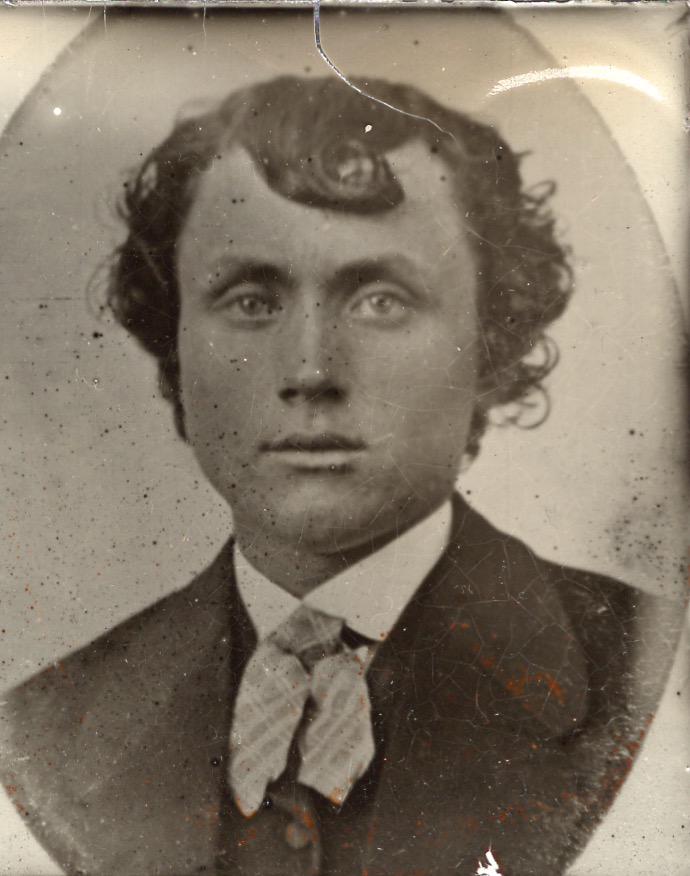
Albert J. Johnson as a young man 
Julia (Guri) A. Torbleau Johnson as a young woman Albert and Julia only lived in Nebraska for six or seven years (1873-1879) and then they packed up and headed back to Wisconsin. Glenrose’s history provides the best information we have as to why:
“The varying prairie weather made crop prospects a gamble every year. Some years were dry and the crops seared in the fields, while strong winds across the prairie never ceased blowing dust. Farms had to be spread miles apart in order for a man to have enough acreage to make a living. With nothing but a sea of wheat between the houses, loneliness was a hardship. Hordes of grasshoppers were always a problem, some years being worse than others. They devoured crops and gardens, stripping the prairie and many farmers were forced to desert their holdings. Albert and Julia Johnson, ruined by a plague of grasshoppers were forced to return to the home of their parents” (Glenrose Johnson’s family history, pp. 7-8).
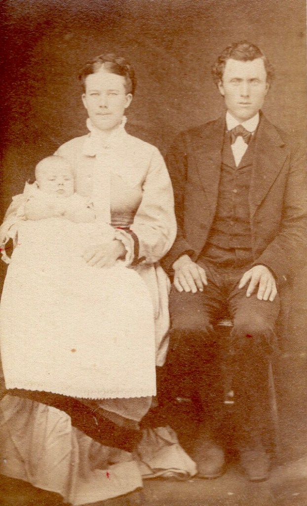
Julia and Albert Johnson with their first child Andrew (photo probably taken in Wisner, NE around 1876) Glenrose’s explanation tracks with historical accounts. An unimaginably large swarm of grasshoppers wreaked havoc across multiple states in the summer of 1874. Nebraska farmers were revisited by smaller swarms in ‘75 and ‘76 (see this link). After having their crops decimated several seasons in a row, Albert and Julia had little choice but to return to Wisconsin. After all, they now had little ones to consider.

Illustration of the grasshoppers stopping a train (source) Julia had given birth to their first three children in Nebraska: Andrew, Nels, and Art. Sadly, of these three, only Art would grow to adulthood. A couple years after returning to Wisconsin, both Andrew and Nels came down with a severe case of measles (what Glenrose calls “black measles” in her history). They died within hours of each other on the same day, February 4, 1882. Andrew was six and Nels was four. The family was devastated.
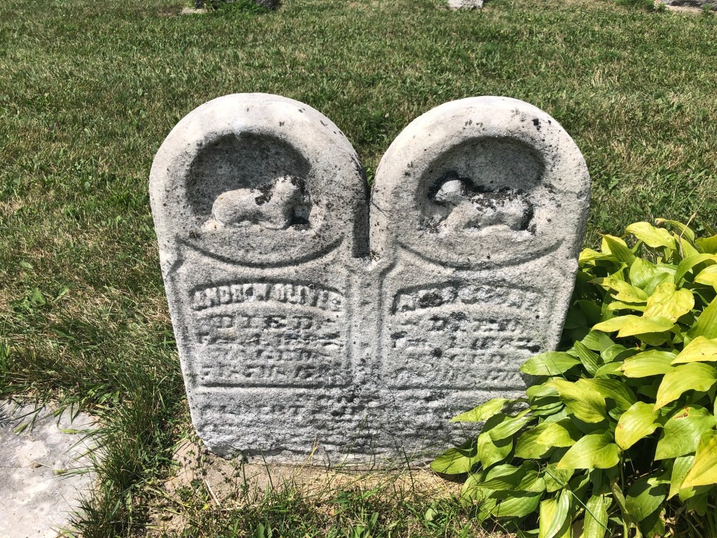
A photo I took in 2019 of the conjoined gravestones for Andrew Oliver and Nels Oscar Johnson, St. Paul’s Liberty Lutheran Church Cemetery, Deerfield, Wisconsin 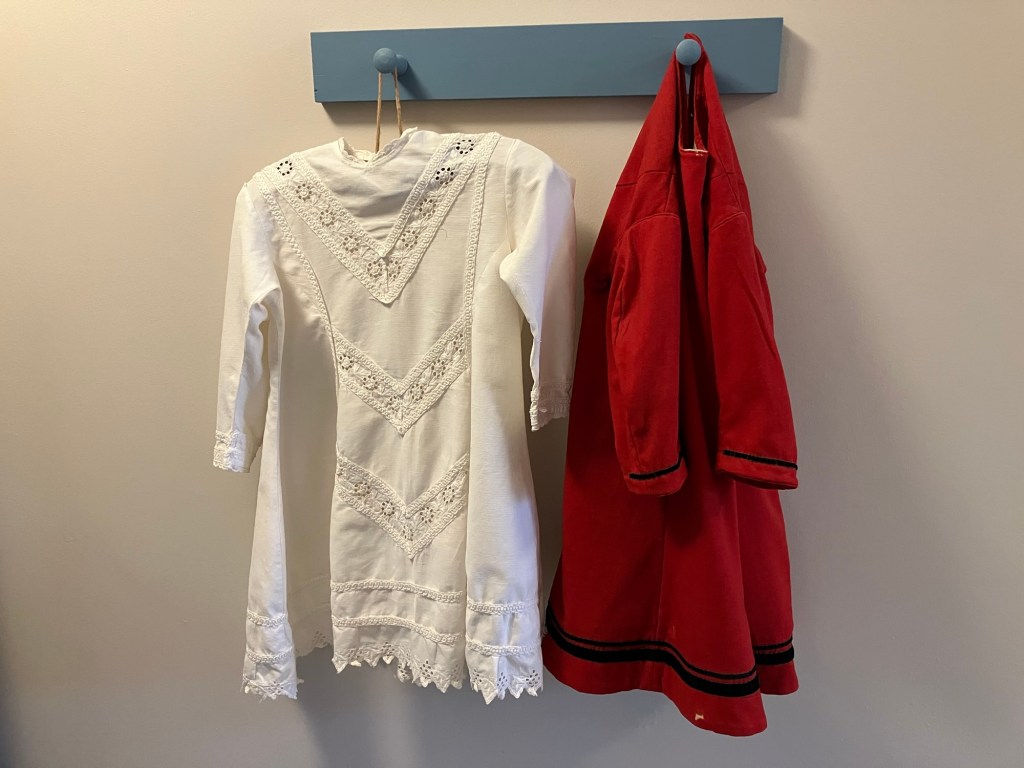
These articles of clothing once belonged to one of the little Johnson boys who died in 1882. They are now in the care of my great-aunt Helen. Photo courtesy of Aunt Helen’s daughter, Julia Reed Meyers (namesake of Julia Johnson). Despite Albert and Julia’s hardships, Albert’s sister Carrie and her Danish fiancé Jens Kringel decided to try their luck in Nebraska. They left in 1881, married, and had their first two children in Wisner. But within five years the Kringel family retreated to Iowa where Jens’s relatives lived. Farming the Nebraska prairie in this era was clearly a struggle.
Albert and Julia went on to be modestly successful farmers and small business owners in Wisconsin, raising eight more children there. Many of these children, like my great-grandma Jessie, would grow up to have large families of their own. Tragically, the Johnsons’ fifth child, named Andrew after their firstborn who died in 1882, passed away at age 25 from a ruptured appendix. Andrew and his brother Art had been keen baseball players in their youth.
Albert and Julia’s fifth child, Andrew Johnson (1883-1909) 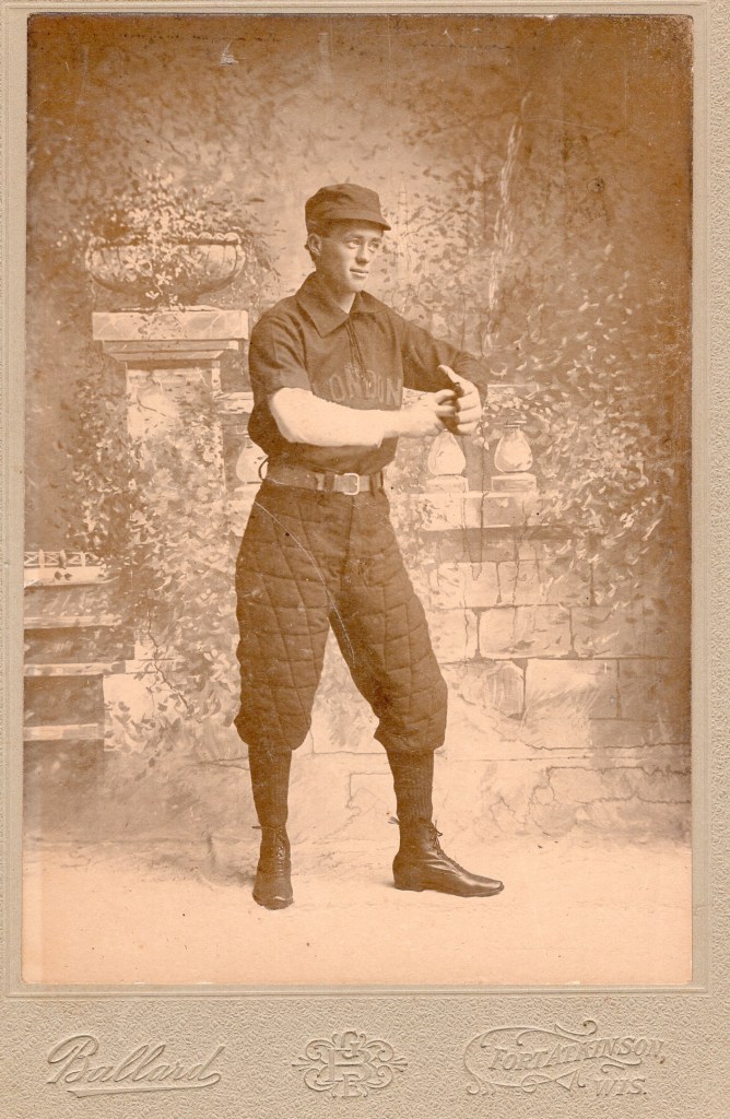
Art Johnson (1879-1967), the only Nebraska-born Johnson to live to adulthood Even though the family had moved back to Deerfield when he was a child, Art ended up marrying Isabel Doxstad — daughter of Ole and Oline Doxstad, who had been part of the same group of Norwegians to settle in northeast Nebraska. So it would appear that despite the Johnsons’ return to Wisconsin, some Nebraska ties were maintained.
When I look at my ancestors’ faces, staring out from old photographs, I see a kind of quiet determination, a resolve to make the best of their lives, no matter what destiny had in store.
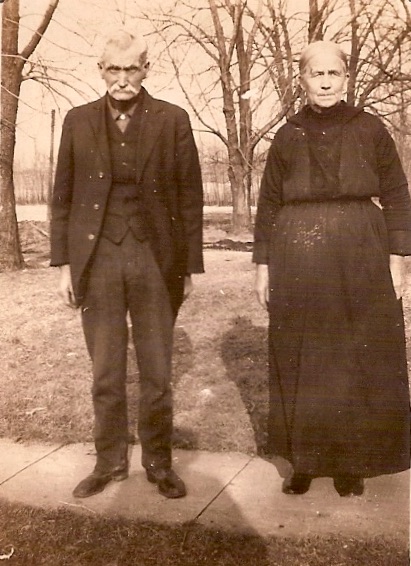
Albert and Julia Johnson (Wisconsin, early 1930s) My great-great grandpa Albert Johnson liked to compose poetry, and you can hear this determination to stay positive in his verses. As the sun sets here on the prairie, I leave you with one of the poems that Albert’s daughter Glenrose preserved in her family history. This is “Once in a While”:
Once in a while there comes a joy
Which makes the tired old man a boy
And brings to the patient mother's eyes
The light of a schoolgirl's glad surprise.
Some little pleasure, too sweet for words
Like the June day song of the summer birds.
Then the bitterness of the life we know
The cares, the trials, the sting of woe
Are all forgotten, and glad we smile
Once in a while.

Once in a while life lifts its mask
And laughs us out of the dreary task
And shows us a world for a little time
That is fairer far than a poet's rhyme;
For the sunshine's out and skies are blue
And joy drips down like the morning dew
And never an old man grumbles low
Of aches and pains that are his to know
For the hours are dressed in their richest style
Once in a while.

Once in a while the cares depart
And peace comes into the aching heart
And the old roof rings with a song of glee
And life is glad as it ought to be.
Then we who have struggled and grieved and wept
Rejoice to think that the faith we've kept.
Our friends are near and this life seems good
And much we have doubted is understood,
For we glimpse the goal of the rugged mile
Once in a while.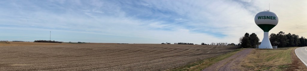
A farm just outside Wisner
* History of the Pioneers. Halderson, H. (1930, April 2). Newman Grove Reporter. https://www.familysearch.org/en/memories/memory/181576246
** I think it’s also significant that Albert’s parents chose to be buried in the Hauge Cemetery outside of Deerfield, Wisconsin. We know that Ole and Malene Johnson were early members of the Scandinavian Methodist congregation in neighboring Cambridge (now called Willerup Methodist — see this post), but their choice of cemetery also suggests a tie to the Hauge Church. Haugean Lutheranism was a popular movement within Norway that gained momentum around the same time as mass migration to the U.S. (for more detail, see this article). Haugean Lutherans emphasized piety, thrift, and diligence, and they distanced themselves from the Norwegian State Church, whose formality they believed robbed people of authentic spiritual experiences. The first Norwegian Lutheran minister in the U.S. was a Haugean named Elling Eielsen, who founded a church — and later an entire synod — at the Jefferson Prairie Settlement (Rock County, Wisconsin) in 1846. Eielsen’s impact on the surrounding Norwegian-American settlements was profound (see this link). A Haugean congregation began in the Deerfield area during Albert and Julia’s childhoods. A church building was constructed in 1862 where the Hauge Cemetery exists today (Hwy 12 & 18), which was later relocated to downtown Deerfield. The man who married Albert and Julia in Nebraska, Ole E. Torgerson, was an ordained lay preacher from this congregation.
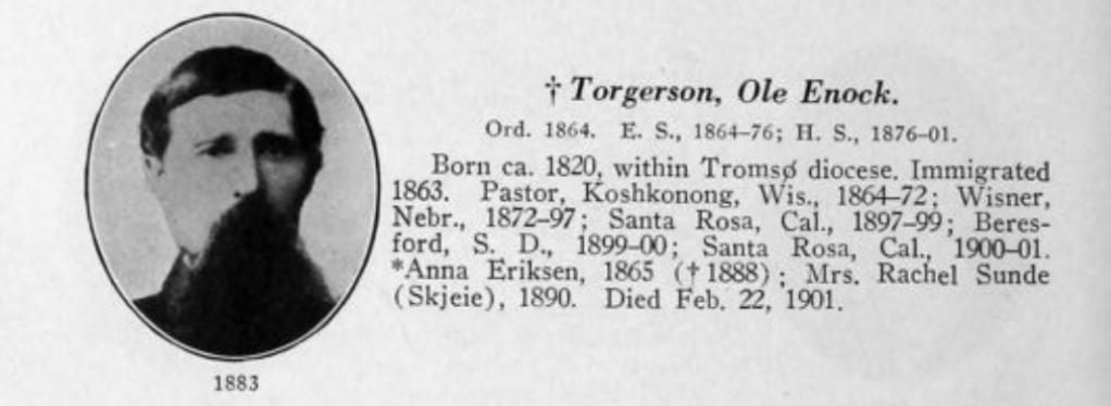
Bio of Rev. Torgerson from p. 602 in Rasmus Malmin and Olaf Morgan Norlie’s (1928) Who’s Who Among Pastors in all the Norwegian Lutheran Synods of America, 1843-1927. Minneapolis, MN. Augsburg Publishing House. 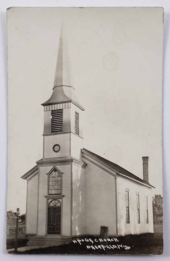
Photo of the Hauge Lutheran Church that used to stand outside Deerfield, WI near the intersection of Hwy 73 and Hwy 12&18 (source: Deerfield Historical Society). In 1894, the church was rolled into Deerfield on logs using a team of horses and stood at the corner of State and Bue streets. The congregation disbanded in 1917, and the church building was torn down in 1964. -
Notes from the heartland (Part 3: Texas)

Happy Rudesgiving!
I can’t remember when Rudesgiving originated, but with such a geographically dispersed family — and with each of my brothers having their own families and in-laws — we needed to come up with our own convenient time to gather. So, for several years we’ve been finding an off-peak weekend to meet up. This year it’s my brother Sam and his family in Texas who are hosting.
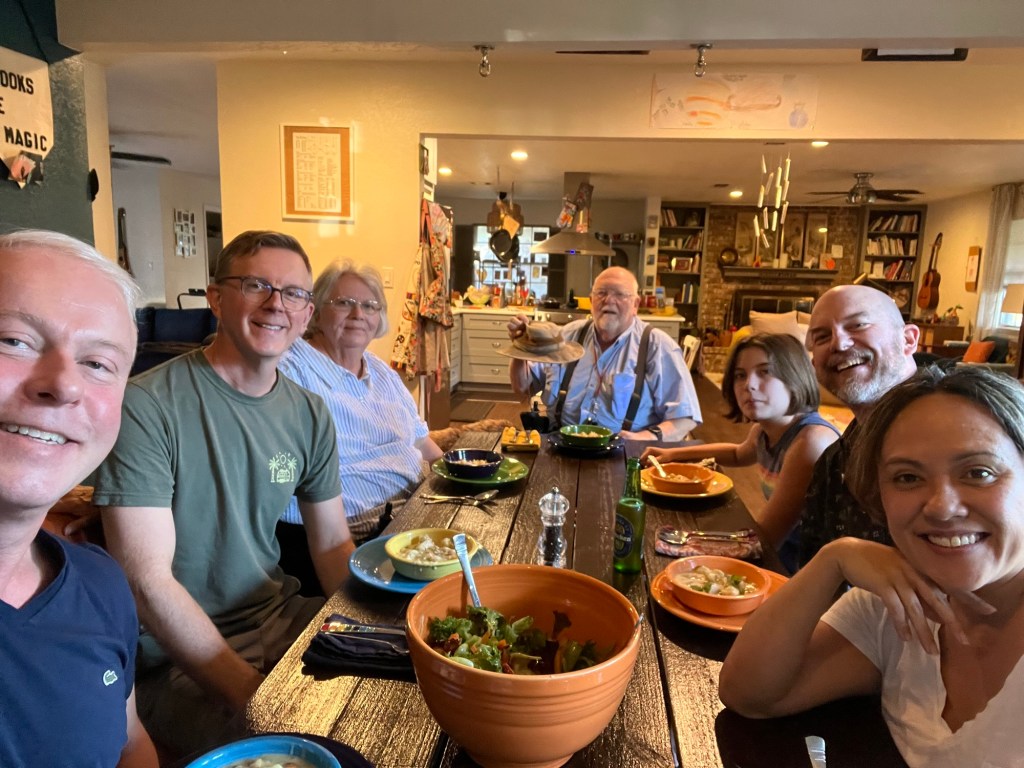
Happy Rudesgiving! But our careful planning was no match for a government shutdown and its effects on air travel. My brother Wayne and his family decided to stay put, rather than risk not getting home in time for an important event, and so sadly they are missing from the photo above.
The home of the Texan Rudes is warm and inviting, and we’ve spent the day eating good food, talking, and playing games. What really makes it feel like a family holiday gathering for me is the coming together of multiple generations under one roof. I don’t get this experience in my daily life, and it’s this missing ingredient that’s so reminiscent of my childhood.
Thanksgivings and Christmases in my youth typically involved driving the five hours from Indiana to my grandparents’ farmhouse in Wisconsin. There we would crowd into the living or dining room with dozens of other relatives and find ourselves picking up conversations we had misplaced months ago. The heat emanating from the kitchen was compounded by the heat of too many bodies in a small space. The sounds of aunties cackling, unsupervised children, whining dogs, clanking plates. Yes, it was a little chaotic, but for me it was heaven.
My mom won’t approve of me writing this, but on her side of the family, chaos was a feature, not a bug, of the holiday programming. It was expected and to some degree I think appreciated. Yes, it could test your patience, but it was also a sign of life. My mom claims that the large family gatherings hosted by her grandparents a generation earlier were a more staid and formal affair, where children were to be seen and not heard. But I’m unconvinced. This photo from Thanksgiving 1953 has a hint of the chaos that I’m talking about.
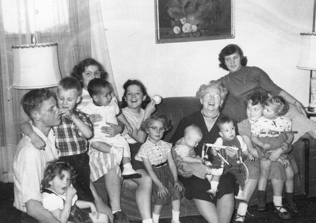
Thanksgiving 1953, home of Jessie & Albert Reiner (Pebble Brook Farm), Cambridge, Wisconsin. From left: Roger Reiner, Beverly Smith (on Roger’s lap), Glenn Smith, Ruthie Reiner, Bobby Nitsch (on Ruthie’s lap), Kathleen Reiner, Janice Quam, Gary Smith (on Jessie’s lap), Jessie Reiner, David Reed (on Jessie’s lap), Joyce Reiner, Charleen Quam, Sandy Quam (on Charleen’s lap) Family gatherings in my dad’s childhood were convivial but maybe slightly restrained, at least compared to today. Grandma Borghild would bring out her best china and children were to mind their manners. You might get a shirt three sizes too small for Christmas, but you needed to thank Grandma anyway.

My dad — at left are his sisters and two cousins. Grandma Borghild Rude in the background. 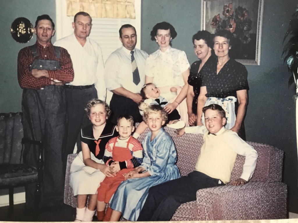
Back: John Rude, Bob Rude, Russell and Evelyn Hexom (holding Gloria), Jean Rude, Borghild Rude
Front: Cathe Rude, Alan Hexom, Marilyn Rude, and Dennis RudeChristmas 1959, home of John and Borghild Rude, Christiana Township, Dane County, Wisconsin (Photos courtesy of Carol Rude Luiso) For today’s festivities in Fort Worth, the multigenerational aspect was on full display when we played “Hitster”. This game requires you to place the songs you pull from a deck into their proper chronological order. My parents were experts in the 1950s, 60s and 70s. My generation did pretty well with the 80s, 90s and early 2000s. And my niece excelled at the 2020s. It struck me that where we all failed was in the late 2000s and 2010s. I suspect that’s where my younger brother Wayne and his fiancée would have put us to shame, had they been with us. Clearly, a rematch is in order!
We dined on award-winning chicken and dumplings… 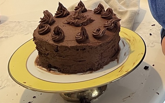
And my niece’s homemade triple chocolate cake! 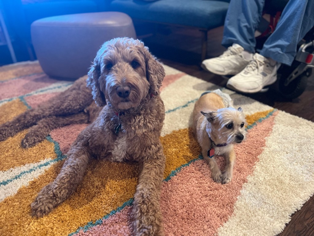
Spence and Peggy Sue relax on the rug 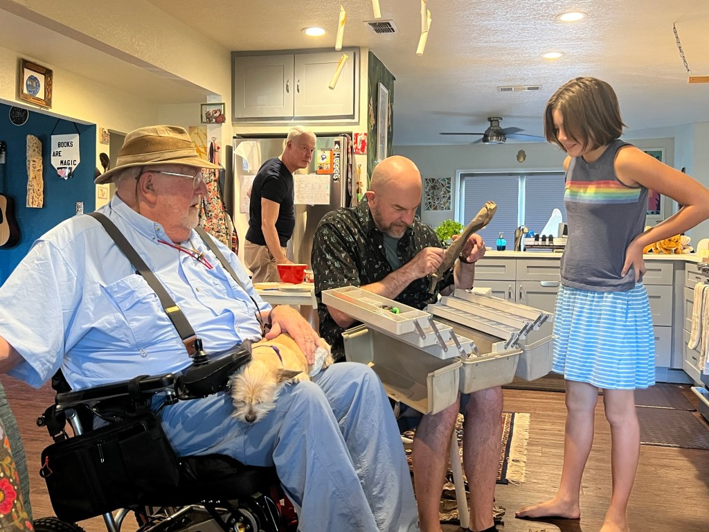
My dad gifted my brother and niece a tackle box full of lures 
Bathroom decor, courtesy of my niece -
Notes from the heartland (Part 2: Kansas and Missouri)
It’s our second day on the road to Fort Worth, and Spence and I are traveling through the rolling hills of the Kansas and Missouri borderlands. Yesterday I told you a little about my 3x great-grandmother’s brothers, John and George Hitz, and how they settled in Iowa with their mother Maria Tontz Hitz after the Civil War (see this post). Now that we’ve reached southeastern Kansas, it’s time to turn to the youngest brother in that family, Christian Hitz.
Girard, Kansas
Christian had enlisted in the Union Army during the Civil War. He served as a sergeant in the 12th Wisconsin Light Artillery Battery, which saw action in several battles in the Deep South, including the sieges of Corinth and Vicksburg. Coming home to Wisconsin after the war, Christian met and married a young lady named Mary Flint. Not long after they wed in 1868, Christian and Mary set out for Kansas.
What attracted Christian to Kansas was the opportunity to run a flour mill with an older cousin. Here I should back up and explain the family tree in more detail.
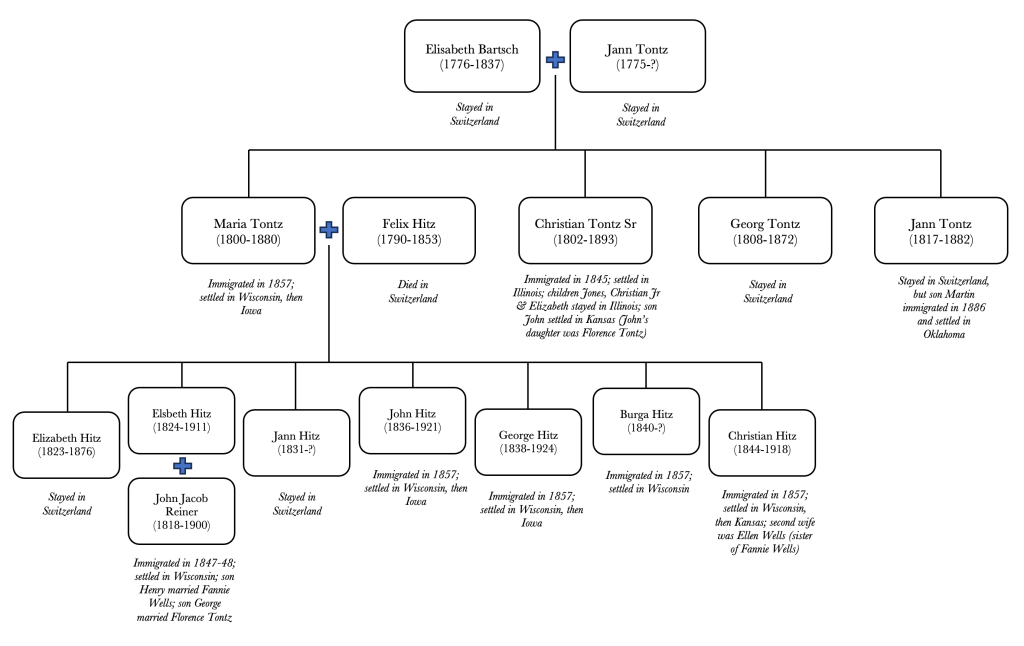
Tontz / Hitz family tree. I am descended from Elsbeth Hitz and J.J. Reiner. Christian Hitz’s mother Maria had a brother named Christian Tontz who had immigrated with his family from Switzerland to the United States (via New Orleans) in 1845. Maria’s brother Christian managed to secure a land patent for a homestead in Madison County, Illinois, not far from St. Louis, and thus the family were among the first white settlers to farm in that area. Christian and Barbara Tontz had four children, the eldest of whom was John Tontz. Sometime in the mid-1850s, John and his fiancée moved from Illinois to Kansas. John Tontz had clearly maintained ties with his family in Wisconsin because in 1869 he recruited his cousin Christian Hitz to join him in Kansas for a business venture. The two men built a flour mill in Girard, which had just been incorporated as a town and was situated along a new train line from Fort Scott.
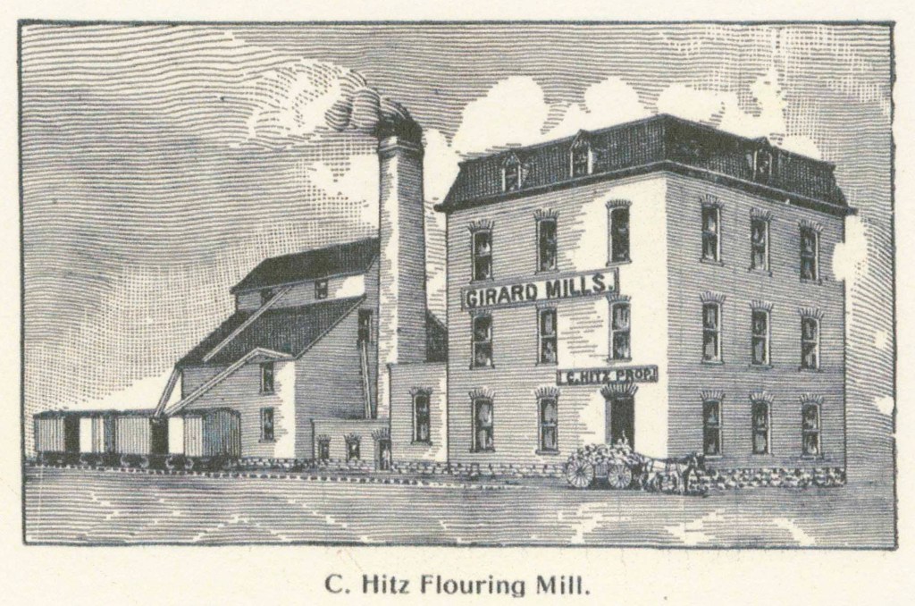
“The Girard Mills were built in 1870, and began operations in the spring of 1871. The first building was a two and a half story frame, costing, with the machinery and power, $10,000. The property was owned by Tontz & Hitz. In 1879, Tontz retired from active participation in the management of the business, and in 1882 sold his interest to Hitz. Mr. Hitz thereupon erected a three and a half story brick mill, put in five run of buhrs, and two sets of Gray’s patent rollers, thus making it a combined mill, which experience has demonstrated to be best adapted to grinding Kansas wheat.” (Excerpt from History of the State of Kansas, William G. Cutler, 1883 by A. T. Andreas, Chicago, IL, retrieved from this webpage.)
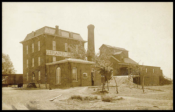
1909 photo of the Girard Mills, owned and operated by Christian Hitz (downloaded from the website https://legendsofkansas.com/girard-kansas/) It would appear that the 1870s and 80s were a boom time for the Girard Mills. But tragedy struck in 1879 with the sudden death of Christian Hitz’s young wife, Mary. A year later, Christian’s mother Maria Tontz Hitz died in Iowa. Sometime between these two misfortunes, Christian must have traveled back to Wisconsin where he met Ellen Wells, the sister of the wife of his nephew Henry Reiner. Christian and Ellen wed in April of 1880.
Ellen Wells was the fourth child of Maria and William Wells, leather workers from Worcester, England who had immigrated to the U.S. in 1845 (described in this post). Ellen’s father had served in the Union Army during the Civil War and died in Virginia from one of the war’s many “camp diseases” (more about William in this post.) Widowed with five young children to care for, Maria Wells quickly remarried in 1865. But nine years later, Maria was widowed again. In 1896, she visited Ellen in Kansas for a few months. According to her obituary in The Girard Press, Maria returned to Wisconsin for a while before coming back to Kansas. On that return trip, she came down with an illness and did not recover. In November of 1897, Maria died at Ellen and Christian’s home in Girard and was buried in the local cemetery.
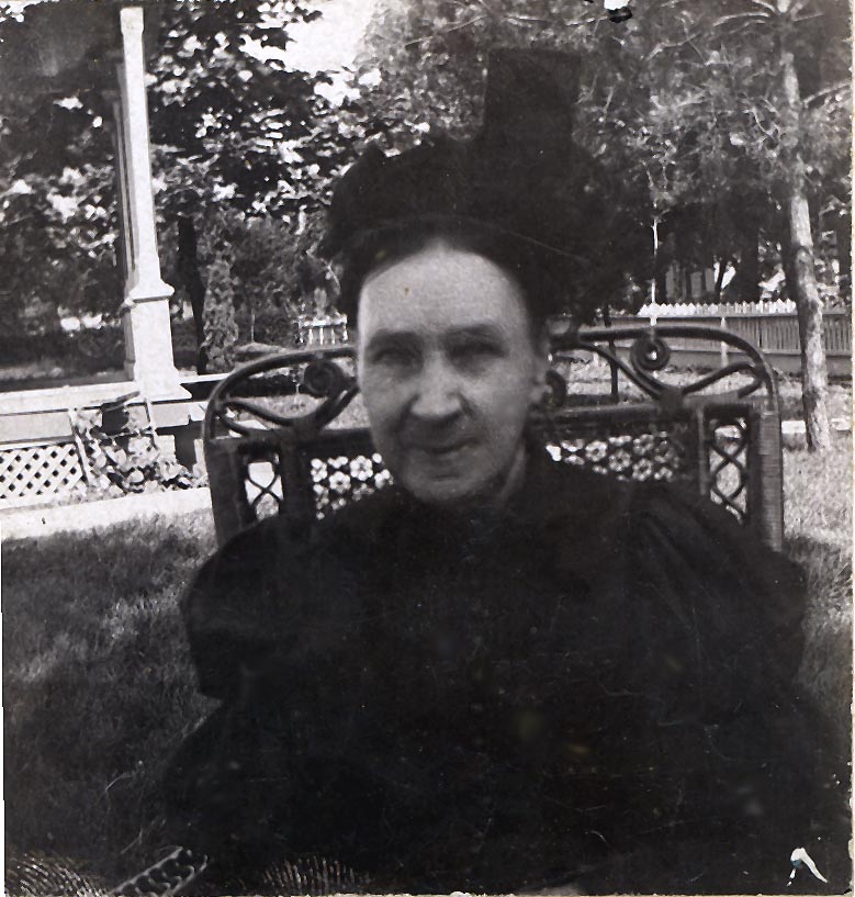
This photo of Maria comes from an Ancestry.com member. Date unknown. 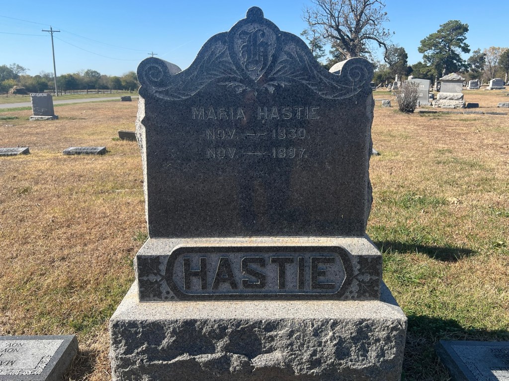
Grave marker of Maria Butler Wells Hastie. Note: Contrary to what it says on the marker, Maria was not born on 1830. She was probably born between 1818 and 1821. 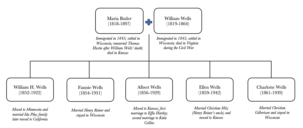
The Wells family of Worcester, England. I am descended from Fannie Wells and Henry Reiner, but our discussion here is about Fannie’s siblings, Ellen and Albert. Albert Wells, brother of Ellen Wells Hitz and Fannie Wells Reiner, also moved from Wisconsin to Kansas to work at the mill. I have been in touch with Albert’s granddaughter, JoAnn Hopper, who is a family historian living in the Houston area. She writes: “Albert wanted a job and Chris [Hitz] invited him to Girard to work in his flour mill. [He] worked there for 40 years. The mill failed in 1924 when recession hit farming country. He married Effie Hartley and they had 3 children. [After their divorce], Albert employed housekeeper/childcare helpers to work at his home. That’s how he met my grandma, Katie Collins and married her in 1903. She revered him and always called him Mr. Wells.”

Gravesite of Albert and Katie Collins Wells A further twist in this tale of interconnected families is that George Reiner, younger brother of my great-great grandpa Henry Reiner, also traveled to Kansas to work in the Girard Mills. It was there he met and married his second cousin, Florence Tontz (John Tontz’s daughter). George and Florence later relocated their family to Detroit, Michigan.
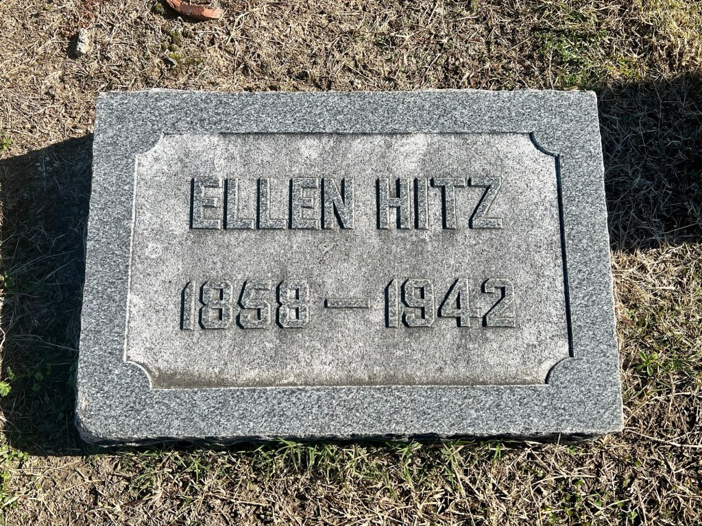

Grave markers of Ellen Wells Hitz and Christian Hitz 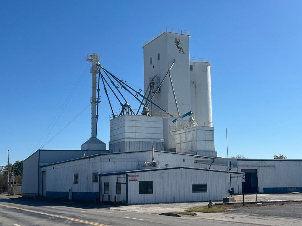
The mill site is now the home of the Producers Cooperative Association, a livestock feed supplier. 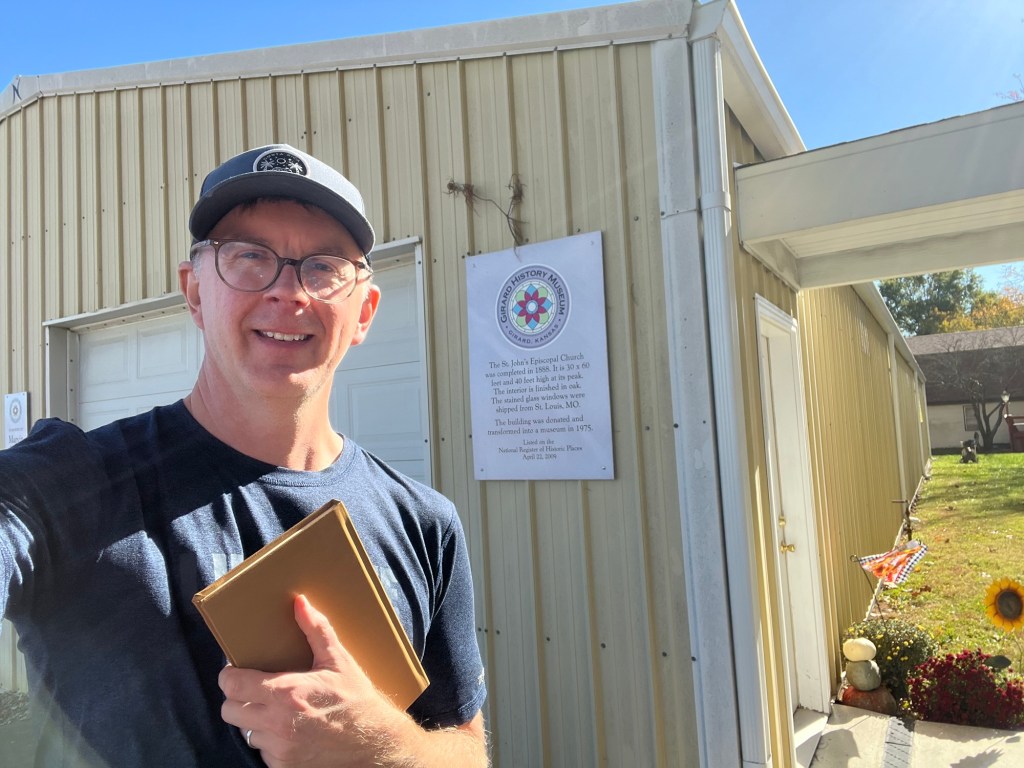
I was lucky to meet a volunteer at the Girard History Museum today who talked to me about the town’s history and sold me a book about it. Despite the area being pretty conservative today, Girard was once a hotbed of radical socialism. Seriously! Check it out: https://explorecrawfordcounty.com/socialist-press-girards-appeal-to-reason/ * POST SCRIPT *
Fort Scott, Kansas and Newtonia, Missouri
Spence and I made a couple of detours today to soak up some Civil War history. In the section above, I briefly covered Christian Hitz’s Civil War record, but I neglected to mention his brother George’s.
George Hitz served in the 9th Wisconsin Infantry (Company F and later C). The 9th was informally known as “the German regiment”, with Company F specifically known as “the Madison sharpshooters”. One of the first places this regiment was stationed was Fort Scott, Kansas.
Is it just me or does Spence seem less thrilled by a visit to Fort Scott? 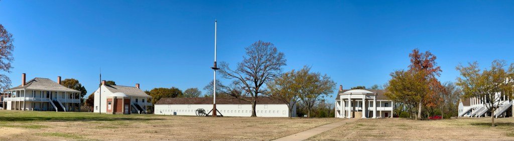
Fort Scott, Kansas The regiment participated in several conflicts in Missouri and Arkansas, including the First Battle of Newtonia. Spence and I had an opportunity to walk around that battle site today.
This is where the battles of Newtonia were fought. The 9th Wisconsin did not succeed in taking this ground, and George Hitz was lucky to make it out alive. 
Description of the battle on a sign at the site (Side note: the 9th Wisconsin was commanded by Frederick and Charles E. Salomon, brothers of Wisconsin’s war-time governor, Edward Salomon. Salomon was Wisconsin’s first German-born and first Jewish governor.)
Neosho, Missouri
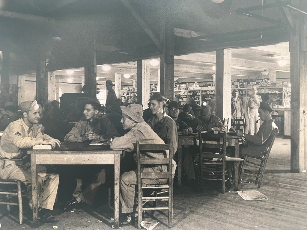
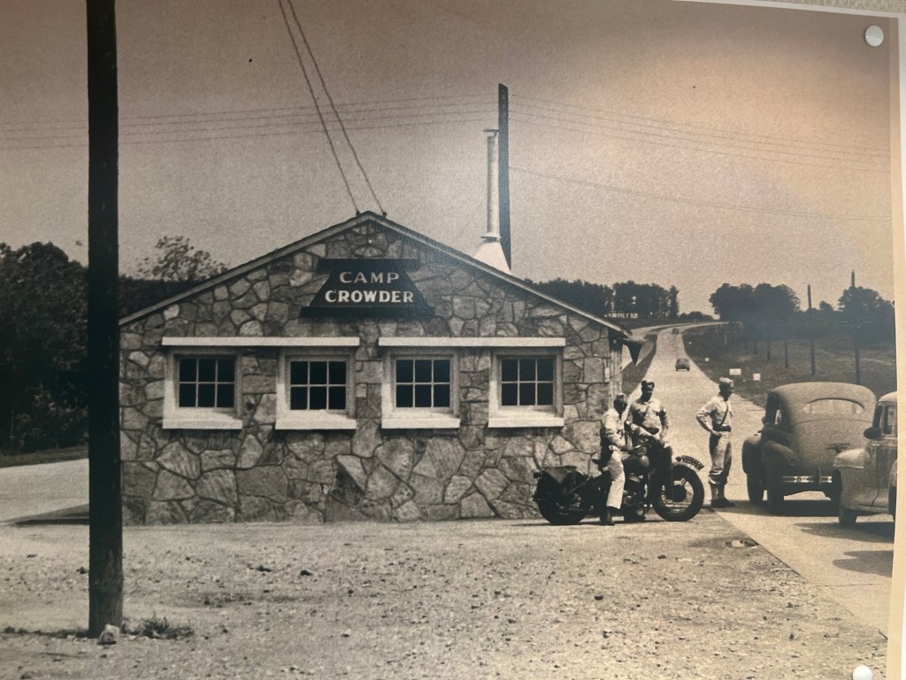
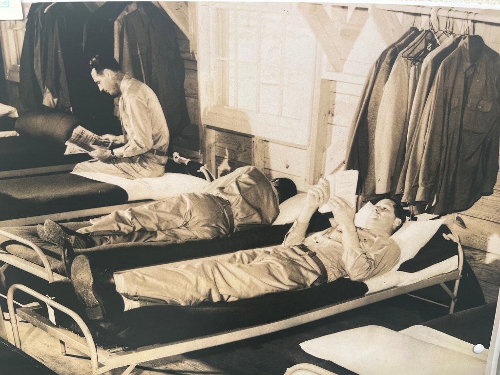
This area of Missouri has a much more recent tie to the country’s military history. Camp Crowder, just south of Neosho, Missouri, was once home to tens of thousands of World War II servicemen training to become Signal Corps radio operators and technicians. The actors Dick Van Dyke and Carl Reiner were alumni of Crowder, as was Mort Walker, creator of the Beetle Bailey comic strip. Walker’s “Camp Swampy” was based on his experiences at Crowder. But more importantly for my family, Camp Crowder is the place where my maternal grandpa Eugene R. Smith was trained before he was sent to England and France in 1944.
I described some of my grandparents’ experiences at Crowder — including their 1943 wedding — in a prior blog post. But I’m adding a few photos of the area to bring those descriptions to life.
Downtown Neosho, where my grandparents were married 

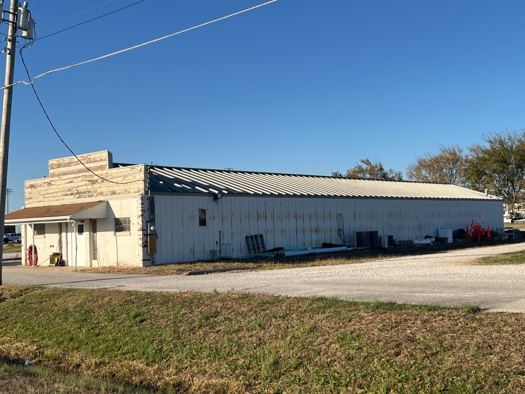
Camp Crowder was converted into a community college campus in the 1960s, but some WWII-era buildings remain. For instance, the college’s machine shed was once the bowling alley. 

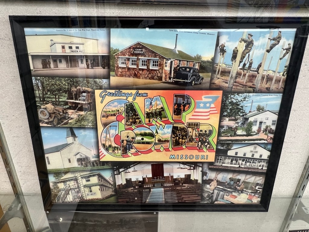
A display in the college library about the campus’ military past -
Notes from the heartland (Part 1: Iowa)
I’m on a kind of pilgrimage through America’s heartland with my trusty companion, my six-year-old Golden Doodle, Spence. This isn’t your average road trip; we’ll be traveling through time as well as space. We have a destination — my brother’s home in Fort Worth, Texas for our family’s off-schedule Thanksgiving (what we call Rudesgiving) — but the destination is only part of the story.

Taking a little break in Dows, Iowa to throw the squeaky ball It is good to have an end to journey towards; but it is the journey that matters, in the end. — Ursula K. Le Guin, The Left Hand of Darkness (1969)
In studying my family’s history, I’ve been especially interested in the migration stories. My branch of the family is unusual in the sense that my direct ancestors, by and large, stayed put after initially settling in southern Wisconsin. But this wasn’t always the case for my settler ancestors’ siblings, many of whom fanned out across the expanse of the North American continent. For these family members, the Atlantic crossing was merely the first in a series of migrations.
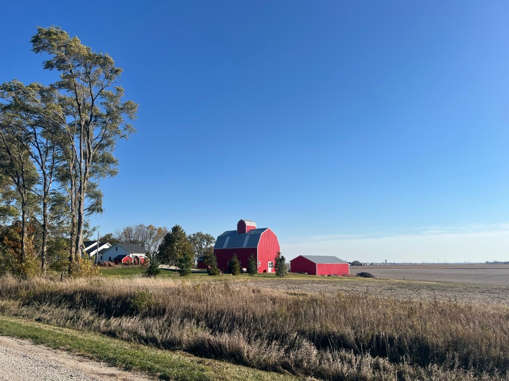
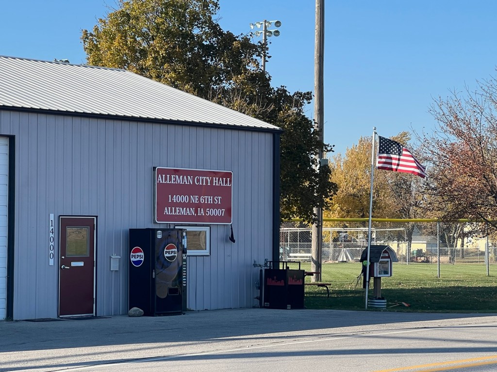
Alleman, Iowa
Our first stop on this trip is a rural community called Alleman, located a few miles north of Des Moines, Iowa. Home to only about 400 residents, Alleman is the kind of town you could easily drive past without noticing. But it’s the final resting place of one of my direct ancestors, my 4x great-grandmother, Maria Tontz Hitz, and so we’ll pause here to pay a visit.


Alleman, Iowa Maria Tontz was born in Seewis im Prättigau, a small village in the Davos/Prättigau region of Switzerland in 1800. In 1857, four years after her husband Felix Hitz’s death, Maria sailed from Le Havre, France to New York with three of her adult children: John (Hans), George, and Burga. Her son Christian had arrived two years earlier, and her daughter Elsbeth (my 3x great-grandmother) had arrived in 1848 to join her fiancé, Johann Jacob Reiner. The entire family settled in or near Madison, Wisconsin — the small capital of the newly minted state. Maria lived with her sons John and George on a farm in the town of Burke, just east of Madison.
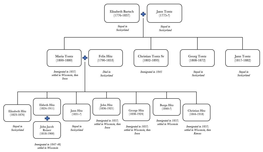
My Swiss roots – the Tontz / Hitz family tree. I am descended from Elsbeth Hitz Reiner, sister of John and George Hitz (see Chart C on this page). The Civil War swept the Hitz family up like it did so many families of the era. Two of Maria’s sons, Christian and George, enlisted in the Union Army, and fortunately both of them made it home. After the war, Christian headed to Kansas (more on his journey later), while John, George and their families headed to Iowa. Maria migrated to Iowa with her sons around 1870 and lived there until her death in 1880.
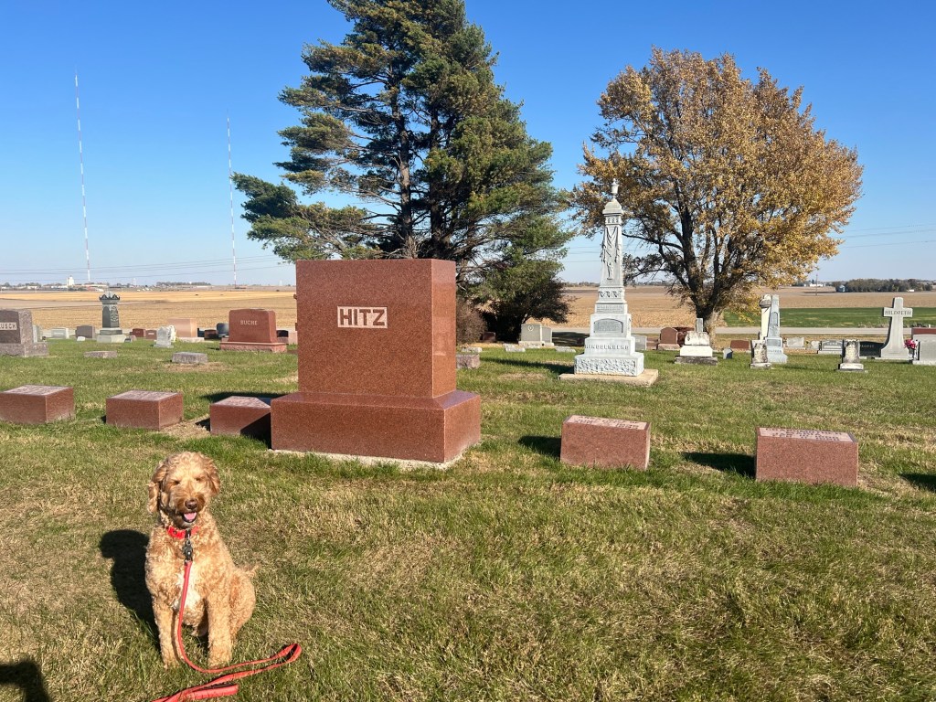
Hitz family plot, Lincoln Cemetery near Alleman, Iowa 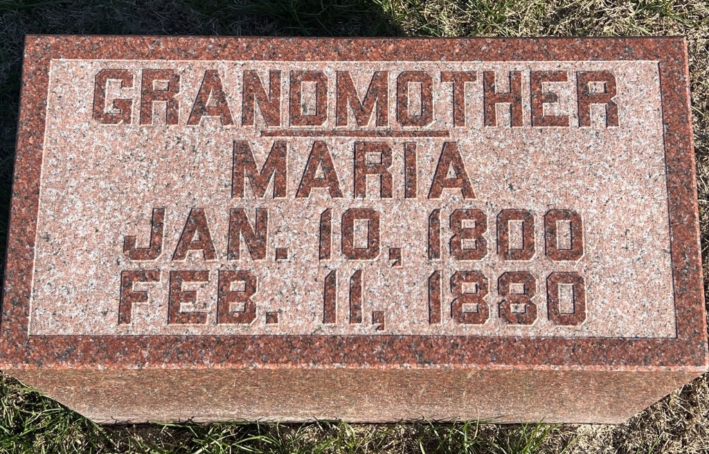
Grave marker for Maria Tontz Hitz The Hitz brothers most likely moved to Iowa in order secure cheaper land. The Homestead Act of 1862 opened up vast tracts of farmland west of the Mississippi River, which homesteaders could claim if they paid a fee and made improvements to the land. Indeed, a 1937 letter written by Elizabeth Reiner Reinking (niece of John/Hans and George Hitz) notes the price: “They lived on my father’s farm for several years before moving to Alleman, Iowa where he (Hans) bought a farm at $2.50 an acre. This was in Civil War times and later became so valuable.”*

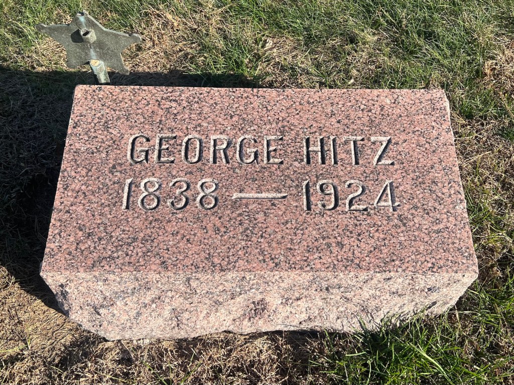
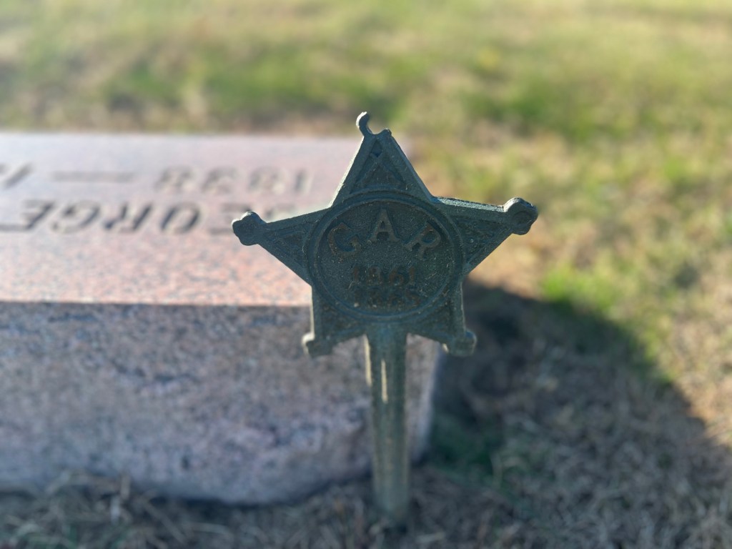
Grave markers of John and George Hitz; note George’s veteran marker 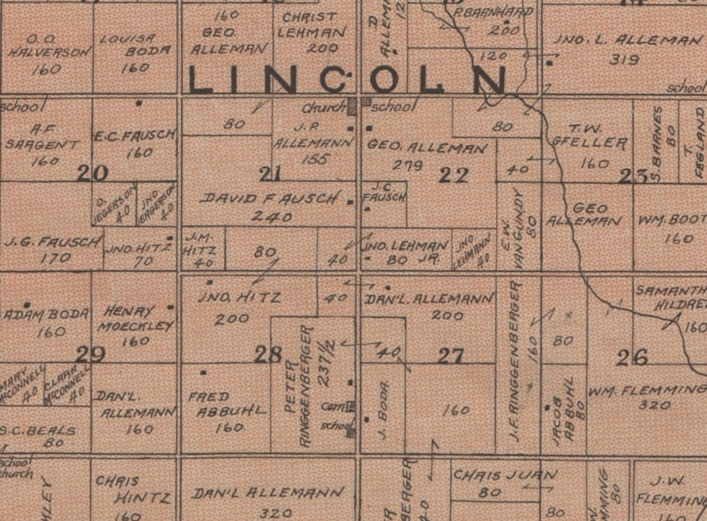
1902 plat map of Lincoln Township in Polk County, Iowa. Farmland owned by John Hitz can be found in sections 20, 21 and 28. (Source:
https://digital.lib.uiowa.edu/node/100697)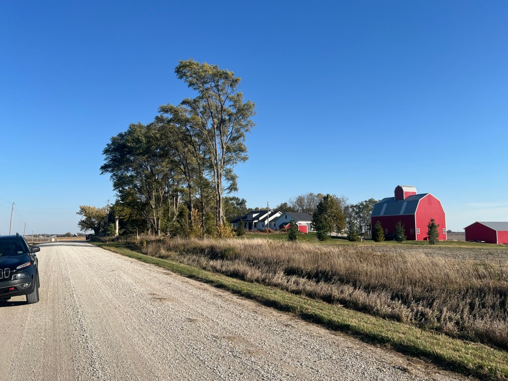
The farm once owned by John Hitz appears to still be a working farm. The house and outbuildings look recently rebuilt. Both John and George ended up having large families, and many of their descendants are undoubtedly living in the area today. It would be fun to meet some of them one day, but now it’s time for Spence and me to get back on the road.
View from the old Hitz farm
* Much of what we know about this branch of the family comes from the hard work of my great-aunt, Helen Reiner Reed, who conducted extensive archival research and preserved many family documents, such as the letters of her great-aunt, Elizabeth Reiner Reinking (1854-1945). The excerpt quoted here is found on page 30 of Aunt Helen’s genealogy, Ancestors and Descendants of Johann Jacob Reiner and Elsbeth Hitz and Allied Lines, published in 1984.
-
Center of the world

My dog Spence and I journeyed to the center of the world on Wednesday. We’re back, and we thought we’d tell you a little about it.

Spence took the opportunity to sneak a kiss while we posed for a selfie at the bdote (Pike Island) Minnesota’s indigenous people have passed down a variety of creation stories. Several of these speak of humankind’s origins at the confluence of the Minnesota and Mississippi rivers. This land has thus been held sacred by the Dakota and the larger Oceti Ṡakowiŋ (aka Seven Council Fires or “Great Sioux Nation”). As described on the website of the Minnesota Historical Society,
“…the spirits of the people came down from Caŋku Wanaġi, ‘the spirit road,’ made up of the stars of the Milky Way, and when they arrived on Earth, the Creator shaped the first people from the clay of Maka Ina, ‘Mother Earth’ at Bdote. The people were the Oceti Ṡakowiŋ, a society that reflects their cosmic origin.“

A map of the area courtesy of https://bdotememorymap.org/memory-map/ The bdote (“confluence” in the Dakota language) was not only sacred but strategic. The colonizing forces from the East Coast understood that anyone who controlled this area controlled the Upper Mississippi and the valuable fur trade within it. More than any other Europeans, the French successfully penetrated the North American interior and forged lasting alliances with the native peoples. They dominated the region’s fur trade for the better part of three centuries, starting in the early 1500s. This dominance ended with the French surrender to the British at Montréal in 1760 – coincidentally, 265 years ago today. Had Montréal not fallen, maybe I’d be writing this post in French.
Cool map of the key players in 1754, created by “Zed3811” (source: https://en.m.wikipedia.org/wiki/File:1754_French_and_Indian_War.png). Note that the bdote is located in that dot of dark blue to the northwest of the “S” in Sauk and Fox. The British took over the French fur trade in the Great Lakes region, but they never fully secured the Upper Mississippi. Under the Hudson’s Bay Company, they did brisk business in the area through the early 1800s, much to the chagrin of the newly formed United States. The U.S. had its own booming fur trade, and after wresting their independence from Britain in 1783, Americans laid claim to all lands south of the Great Lakes and east of the Mississippi. And then in 1803 the U.S. negotiated with France to gain rights over the vast plains west of the Mississippi – the Louisiana Purchase.

An 1814 map of the Louisiana purchase, courtesy of the Library of Congress (source: https://lccn.loc.gov/2001620467) But in practice, “Louisiana” was neither French nor British nor Spanish nor American. It was controlled by dozens of native nations, who had ceded nothing in 1803. The U.S. government, through its representative Lt. Zebulon Pike, made a shady treaty with the Dakota people in 1805 to secure land at the confluence of the Minnesota / St. Peter’s and Mississippi rivers and build a fort there. But a fort wasn’t built at the bdote until the 1820s. Both U.S. and British authority in the region was tenuous at best throughout the early 1800s. The situation almost ensured conflict.
British sketch of the fort at Prairie du Chien (source: https://www.wisconsinhistory.org/Records/Image/IM42230) The struggle between Britain and the U.S. for regional supremacy came to a head at the 1814 Battle of Prairie du Chien, a little-known chapter in the War of 1812. Under the command of Missouri Territory Governor William Clark (yes, that William Clark), the Americans hastily built a fort near the old French trading post of Prairie du Chien, situated at the confluence of the Mississippi and Wisconsin rivers. The Wisconsin River was a key artery in those days because it linked the Mississippi with the Great Lakes (via a portage to the Fox River), and thus the Atlantic. Unfortunately for the Americans, the fort at Prairie du Chien was captured by the British and their Ho-Chunk and Menominee allies a mere month after it was built. The British handed it back to the Americans once the war concluded in 1815, but first they gave it the same treatment they gave the White House: they burnt it to the ground. Had the war wrapped up slightly differently, the Upper Mississippi might have been included in Canada.
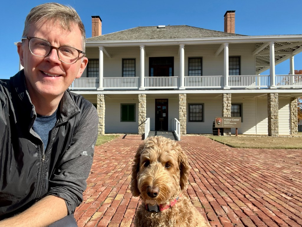
Anxious to secure the new territory, the Americans finally built their fort at the bdote in 1822. Sadly for Spence and me, dogs can’t take the tour at the fort, so I came back without him the next day.
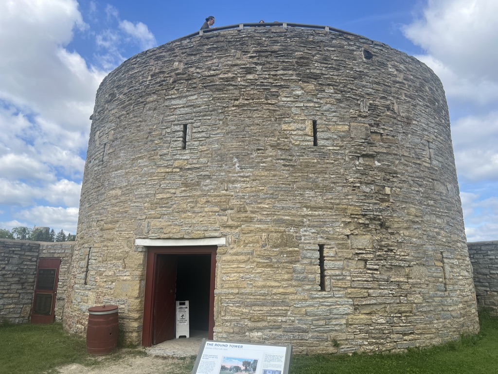
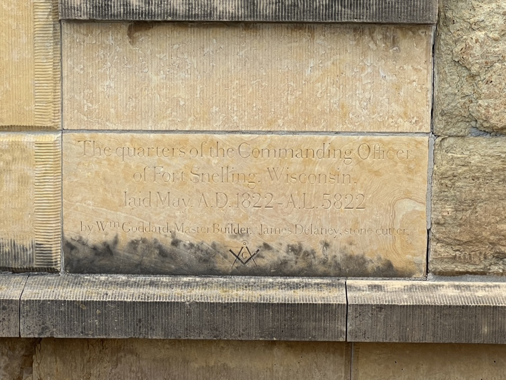
Named after its first commander, Fort Snelling is situated on the bluffs overlooking the confluence of the rivers below. In a strictly militaristic sense, Fort Snelling never saw “action”. A third conflict with Great Britain never came and no battles of the Civil War were waged in this region. Even during America’s wars with native peoples, Snelling wasn’t attacked. But the fort has borne witness to American history in other ways.
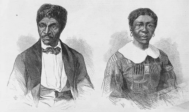
Dred and Harriet Scott (image courtesy of the National Park Service: https://www.nps.gov/jeff/planyourvisit/dredscott.htm) For instance, in 1837 a U.S. Army doctor by the name of John Emerson came to reside at Snelling with an enslaved man he had purchased in Missouri — Dred Scott. There Mr. Scott fell in love with and married Harriet Robinson, an enslaved servant of Fort Snelling’s Indian agent, Lawrence Taliaferro. Taliaferro, acting as justice of the peace, performed the marriage himself and allowed Mrs. Scott to be transferred to Emerson. Emerson got assigned to various posts in the Midwest and brought the Scotts with him. After Emerson’s death, the Scotts tried to buy their freedom from his widow. When she refused, they sued for their freedom, claiming that they had been held illegally in non-slave states and territories (Fort Snelling was, at this time, in Wisconsin Territory, where slavery was illegal.) The case went all the way to the Supreme Court and the Scotts’ legal defeat further flamed the tensions in the lead up to the Civil War.
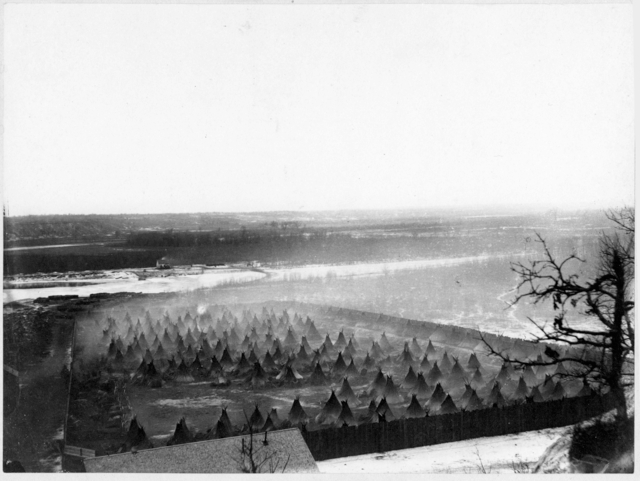
The concentration camp at Fort Snelling (late 1862 or early 1863), source: https://www.mnhs.org/fortsnelling/learn/us-dakota-war During the Civil War, Fort Snelling was an important site for Minnesota soldiers to be recruited and trained. Some 25,000 soldiers passed through the fort during the war. Meanwhile, in the war’s second year, Minnesota’s Dakota people faced starvation due to their treatment at the hands of American settlers and the broken promises of Indian agents. A faction rebelled, killing five white settlers and kicking off a series of conflicts known as the Dakota War. U.S. Army regiments put down the rebellion and rounded up hundreds of combatants. Over 300 Dakota men were sentenced to death and 38 were hanged at Mankato after short and unfair trials. Over 1,600 non-combatant Dakota people were forced into a concentration camp set up at Fort Snelling. In the conflict’s aftermath, almost all Dakotas in Minnesota were exiled to far-flung reservations, as were 2,000 Ho-Chunk people who had not participated in the war.
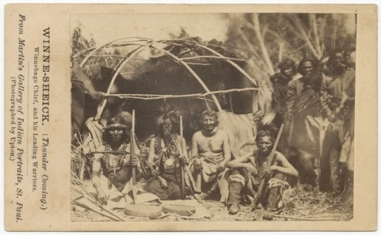
Photo of Ho-Chunk leaders, probably taken at Fort Snelling, courtesy of the Minnesota Historical Society (source: https://www3.mnhs.org/mnopedia/search/index/event/ho-chunk-and-blue-earth-1855-1863) Snelling continued to be an important military recruiting station for the next century of wars – the Spanish-American War, World War I, and World War II. As a former student of Japanese, I was fascinated to learn that Snelling was also the site of a Japanese language academy during the Second World War. The Military Intelligence Service Language School (MISLS) trained over 6,000 men and women of Japanese ancestry in language skills that would help the U.S. armed forces decipher Japanese communications. They played a key role in Japan’s defeat. It’s a sad irony that most of these vital contributors were recruited out of the interment camps that the U.S. government had forced Japanese Americans into during the War.
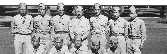
Image of MISLS attendees, courtesy of the National Park Service (source: https://www.nps.gov/miss/learn/historyculture/langschool.htm) Spence and I had come to walk the bdote, the confluence of rivers. What we discovered was a confluence of histories, some proud and some painful, and a true center of the world.
Pike Island is quiet and beautiful, and probably a much easier hike than Pike’s Peak 
Where the Minnesota and Mississippi rivers meet, the bdote at Pike Island 
View of the bdote from Fort Snelling -
Glimmers from a golden age

Norway is one of those countries – like Macedonia or Mongolia – that has a modest footprint today but once settled and ruled distant lands. This is not to say that Norway’s best days are behind it. But it does have a storied, almost mythic past. Unlike the Greeks and Romans, the Old Kingdom of Norway did not leave behind much in the way of monumental architecture. Much of what was built was made of wood, and wood doesn’t tend to stick around.
But now and again in Norway you’ll come across a relic from this bygone era.
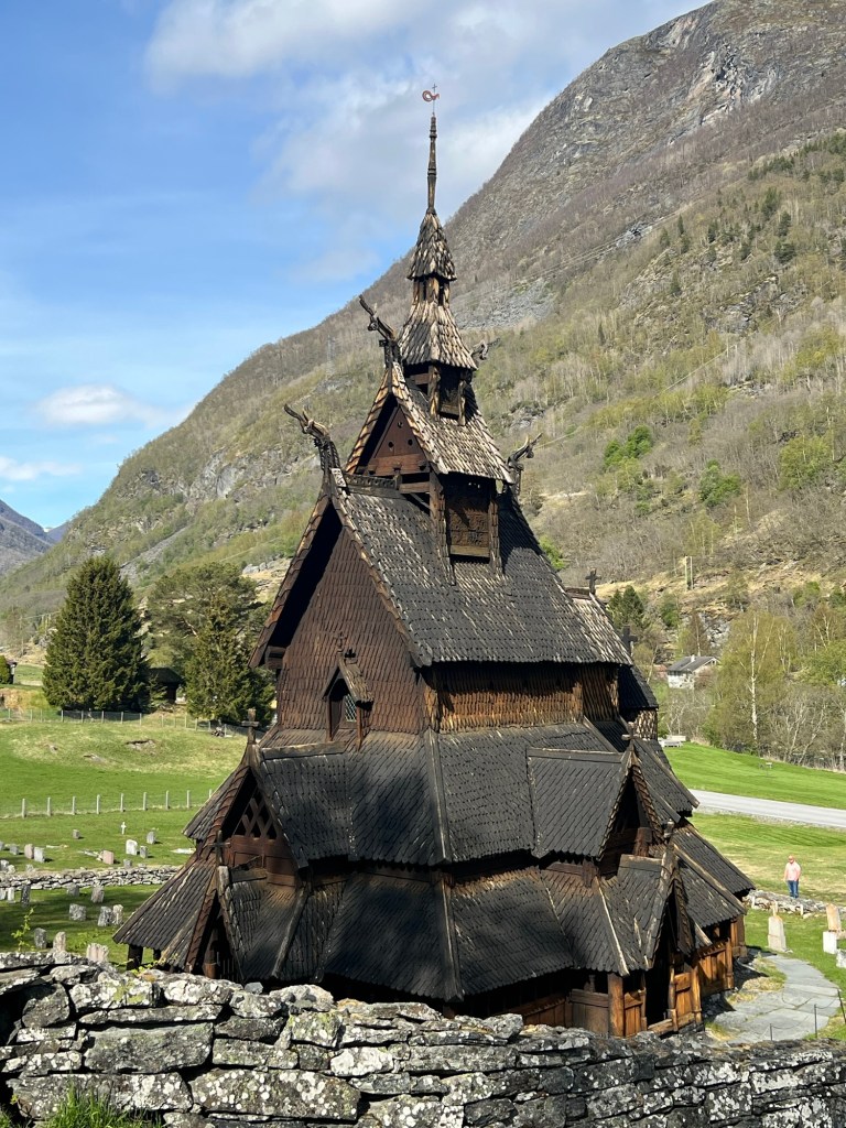
Borgund Stavkirke 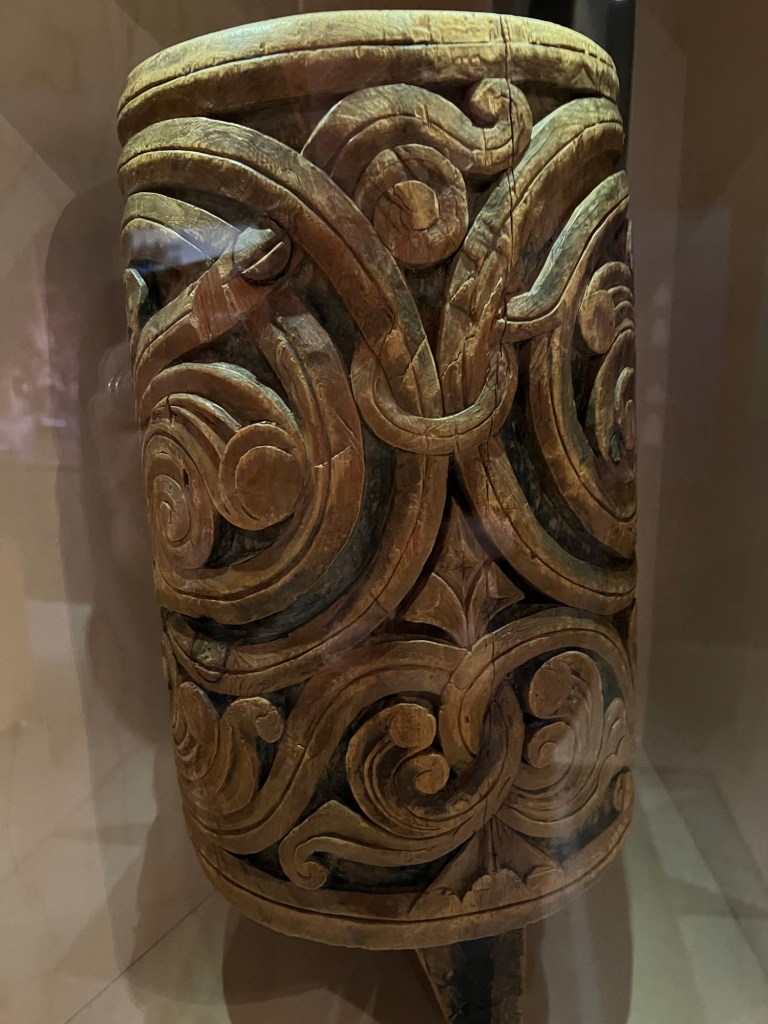

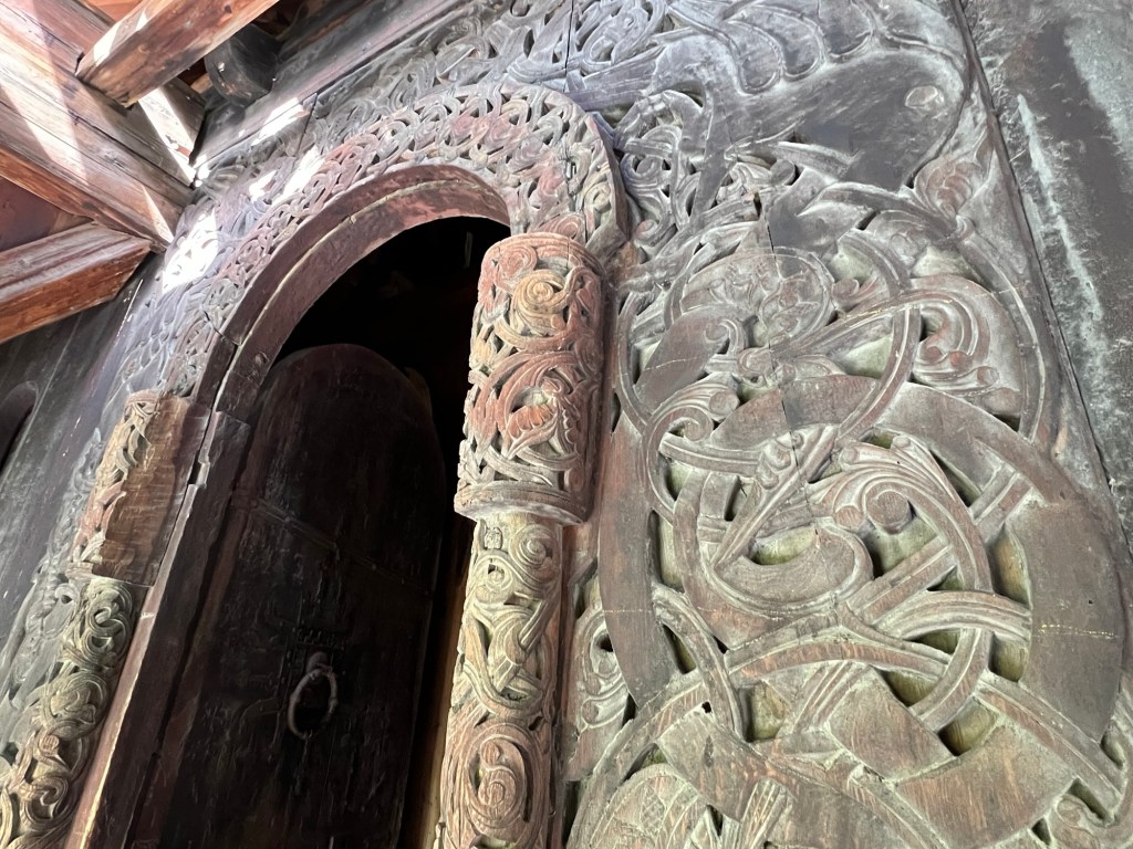
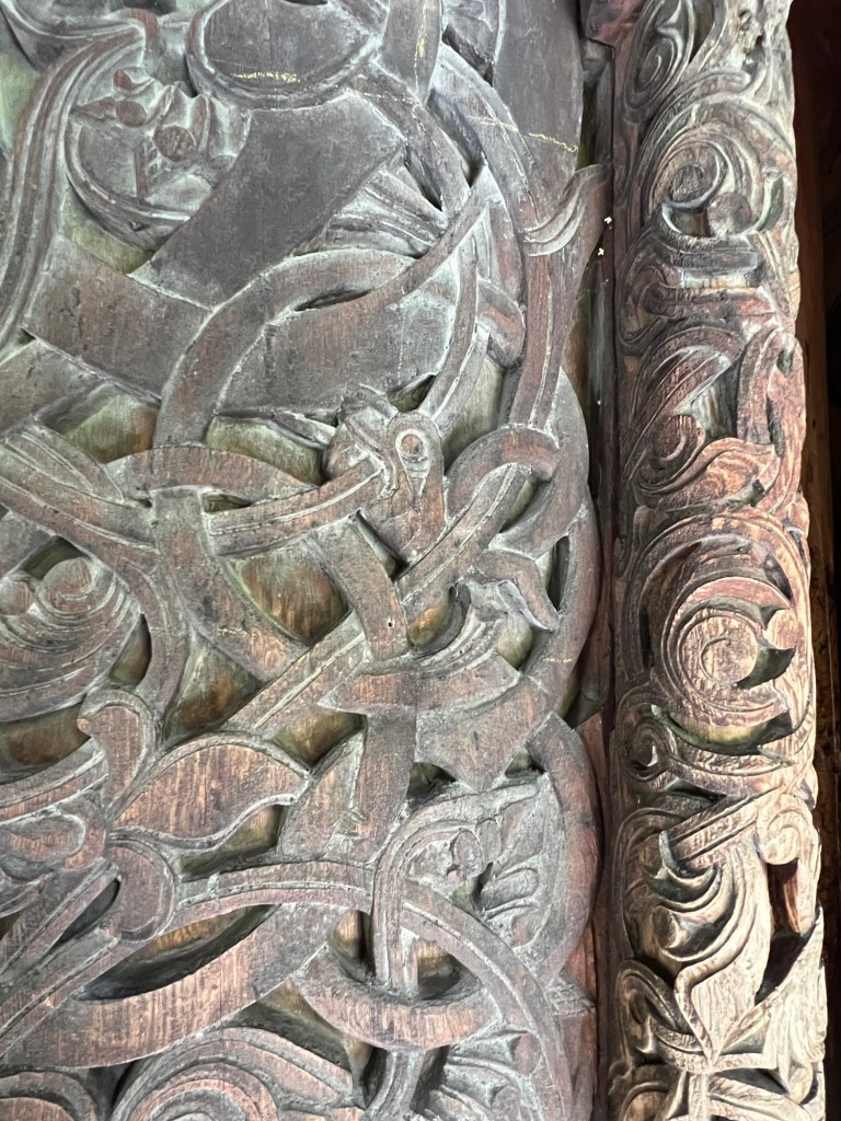
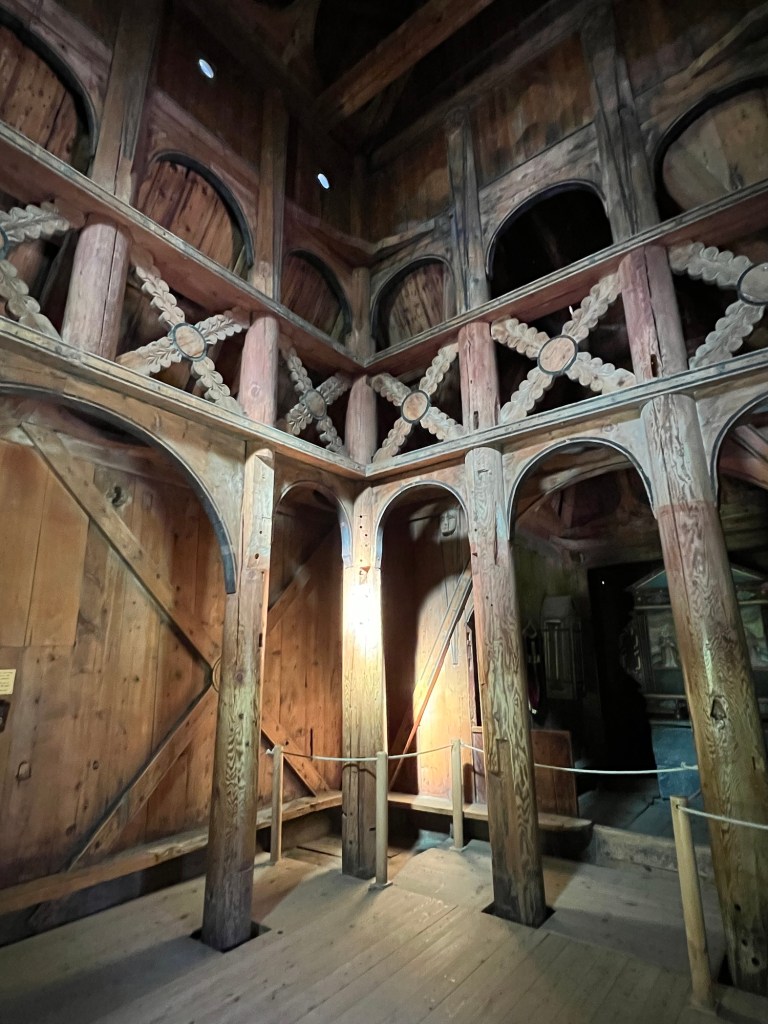
The carvings at Borgund evoke Viking stonework. I had the opportunity to see Borgund on May 9th, a bright afternoon. But stepping inside, it was surprisingly dark. When Borgund Stave Church was built, circa 1200, Norway was going through a period of intense civil war — internal conflicts that didn’t end until about 1240. The kingdom’s holdings at that point stretched from Båhuslen in the southeast (now part of Sweden) to Iceland and Greenland in northwest. In between, the Kingdom of Norway ruled parts of Ireland and Scotland, as well as the Isle of Man, Orkney, Shetland, the Hebrides and the Faroes.
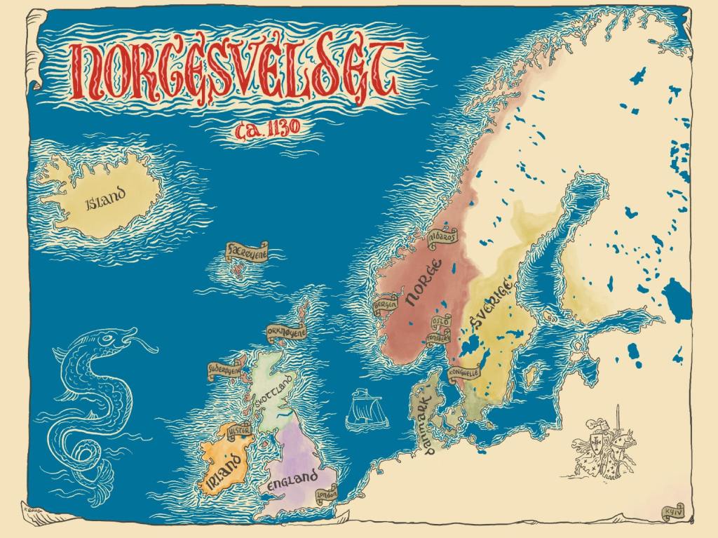
Illustration by Kristian Krohg-Sørensen (downloaded from the Norwegian National Library website) Central to the administration of this expansive kingdom was the Norwegian Church. Norway was becoming Christian in exactly the years when it acquired overseas territories (between about 1000 and 1150). Despite the kingdom’s strong association with Christianity, elements of pre-Christian style shine through in those early churches.
Prior to the Black Death in 1349, there were over 1,000 stave churches in Norway. Today only 28 are still standing (see www.stavechurch.com).
Lomen Stave Church, built around 1192. Just a drive-by photo op on my journey east (May 9th). 
Garmo Stave Church, built around 1150, disassembled in 1882, and rebuilt at Maihaugen in Lillehammer in 1921. I visited this church with my relative Mathilde Hanssen on May 14th. The Black Death was the beginning of the end of Norway’s “golden age.” In less than 50 years, Norway was absorbed within the Kalmar Union. The country’s population didn’t recover for another 300 years, by which point Norway was a jewel in Denmark’s crown. That diminished population could not sustain all those churches, and many were demolished. Several stave churches that remained intact during those years were later razed during the Reformation (post-1537).
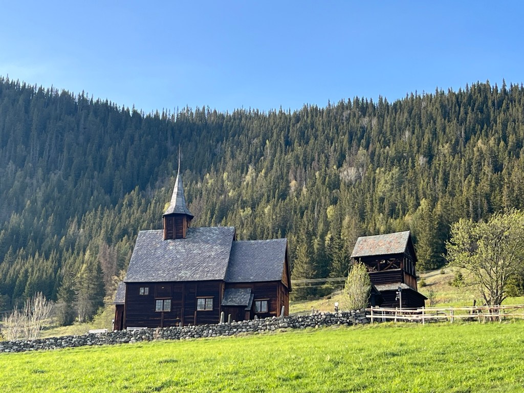
The old stone churches of the early Middle Ages fared much better. There are over 150 stone churches from that era still standing in Norway, most of which were built between 1150 and 1250. On May 10th, I had the opportunity to visit one of them — Balke Church in Østre Toten, where my great-grandma Borghild Helgestad was baptized.

Balke was built high on a hill so that parishioners could hear its bells for miles around. The construction combines elements of Romanesque and Gothic styles. The semi-circular apse with half-domed vault was difficult to build at that time and, according to Mr. Øksne, speaks to the importance of the parish. 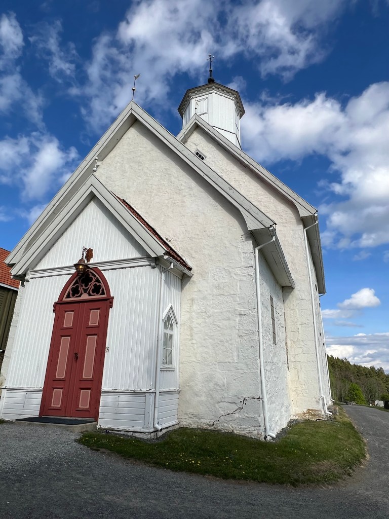
Entrance 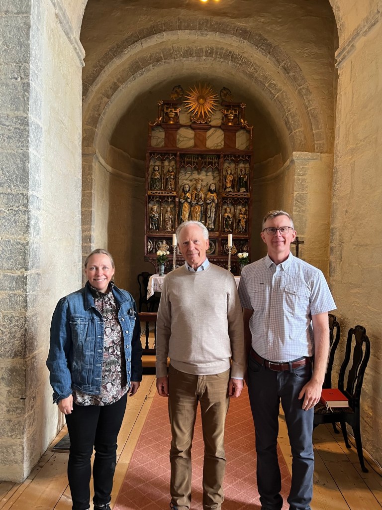
Hilde, Mr. Øksne & I 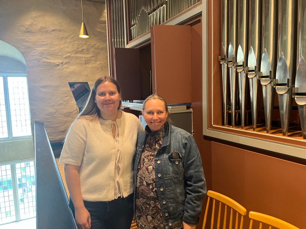
Mathilde & Hilde 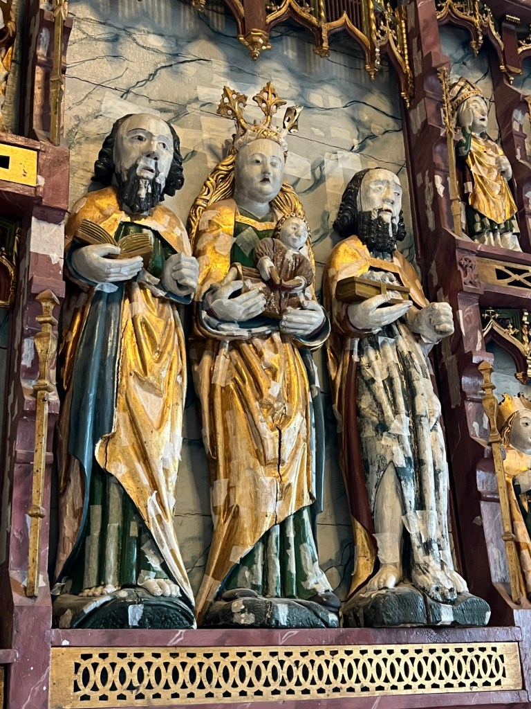
Altarpiece (central panel) 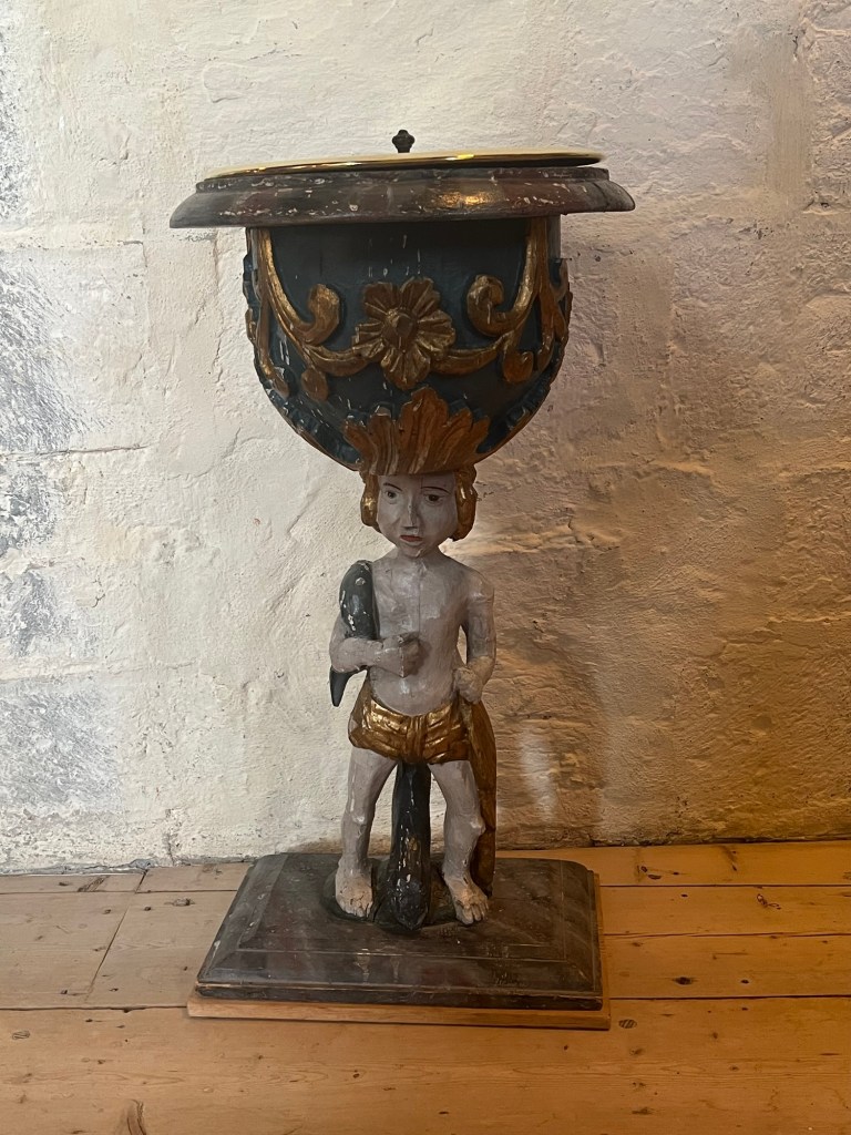
This baptismal font was used here since 1719 
The magnificent altarpiece was consecrated in 1526 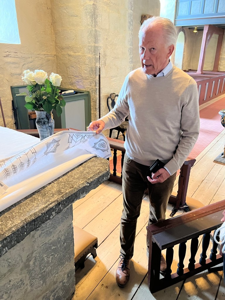
Mr. Øksne points out the altar 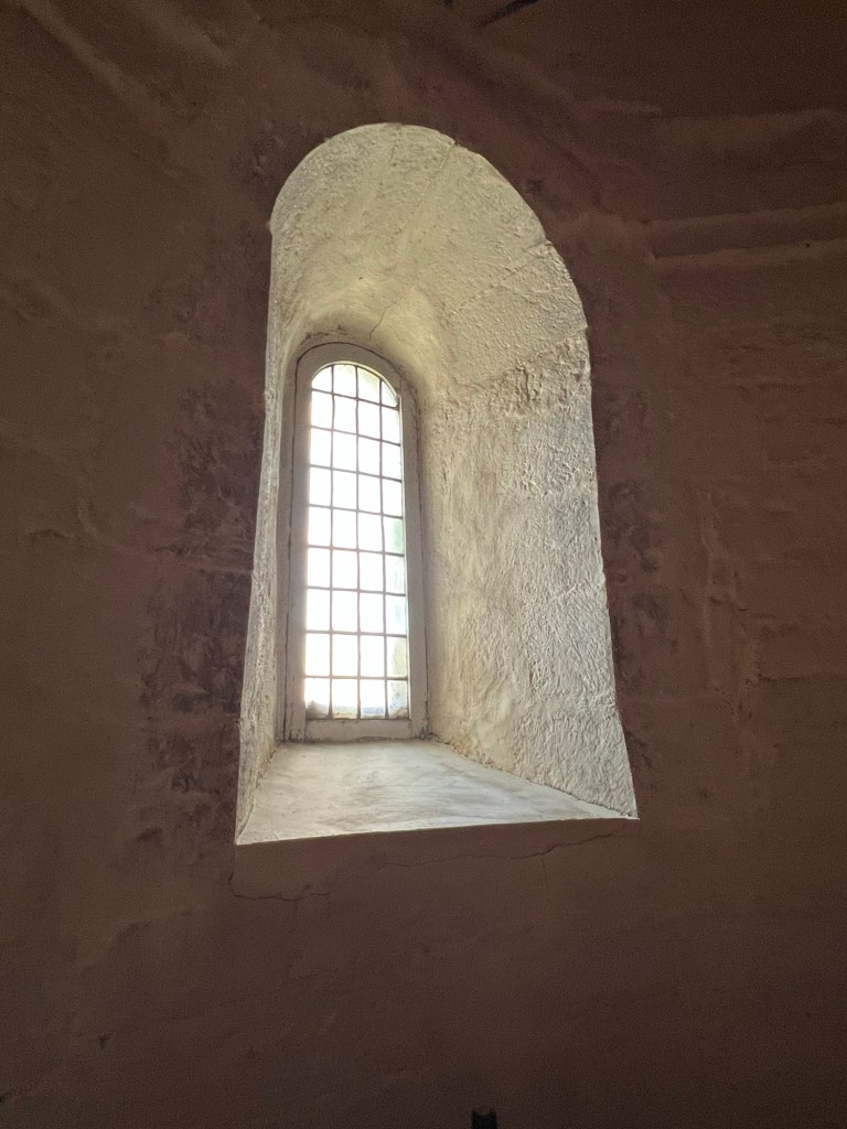
Balke is a two-walled structure with filling (1.5 meters thick) Mr. Roar Øksne, the former verger, was kind enough to give me and two of my local relatives (Hilde Iversbakken and Mathilde Hanssen) a detailed tour of this impressive structure. Mr. Øksne explained that Balke was probably built around 1170 but underwent major renovations in the 18th and 19th centuries.
He painted a vivid picture for us of what people experienced when they walked into the church in the Middle Ages. The windows were even smaller than they are today, making the interior dark. The parishioners had to stand during services, huddled together in the unheated building, and their participation in the service was minimal. In those days, Mr. Øksne explained, a church service focused more on the rituals between the priest and God — the congregation were mere witnesses to the event.
I wonder if this was true in all of Christendom, or if this was a holdover from how earlier generations of Scandinavians worshiped. I visited the University of Bergen Museum on May 21st, and a display there highlights how the image of Christ changed during the early Middle Ages in Norway. Three crucifixes are juxtaposed: the one at left from about 1150, the one at right from about 1275, and the one at back from about 1330.

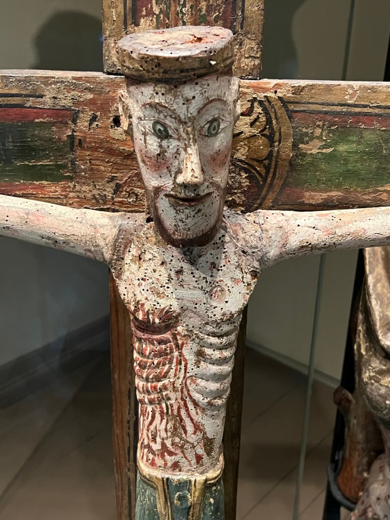
The oldest of these, explained a guide named Thomas, is looking straight at you. The people of that time would never accept a God who bowed his head. He needed to be a strong leader you could follow into battle. He suffers but faces death with eyes wide open.
Relic shrine from the Church of St. Thomas in Filefjell, ca. 1230-1250, University of Bergen Museum. This piece blends classic Norse elements with images of Christ and his followers in Roman togas. And so it is, I suppose, in all times of cultural transition. We transmit new messages using the vocabulary of the past. This was true in a literal sense in the early Middle Ages, as the older runic writing system — believed to have been Odin’s reward for sacrificing himself — was used to convey Christian blessings and prayers.
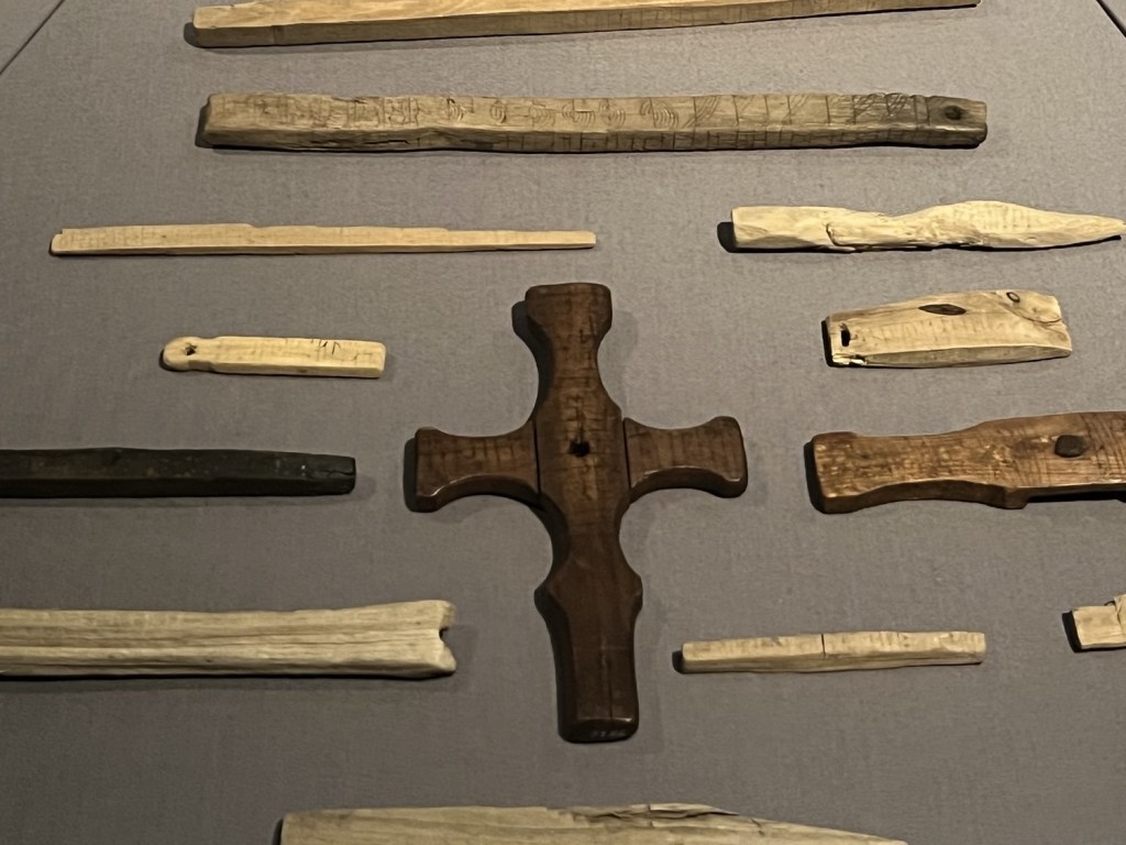
A photo from my visit to the Bryggens Museum in Bergen on May 22nd. This museum houses the largest collection of runic inscriptions in the world. All of the inscriptions in the photo above use the runic alphabet, although some are in Old Norse and some are in Latin. All pieces date from the 1100s, 1200s or early 1300s. When we interpret the past, we naturally use the vocabulary of the present to understand it. This “back translation” allows for clarity, but of course something is always lost in translation. Much of what we know about Viking Era history and religion, for example, comes from the sagas written down centuries later by the Icelandic poet Snorri Sturluson (1179-1241).

A copy of the Sagas of the Kings, on display at the National Library in Oslo (photo from my visit on May 15th) In Sturluson’s “histories”, the stories of historical figures blend with both Biblical and Norse legends. It can be hard to parse fact from fiction.
This morning (May 23rd) I had the chance to visit the National Museum of Iceland — a final stop before heading home. Here the 13th century is remembered differently: not as a “golden age” but as an era of subjugation under the Norwegian kings. It’s the period just prior — what we might call the Viking Era or what the Icelanders call the Age of Settlement — that is probably the most romanticized here.
Norse society’s transition in the early Middle Ages from pagan Viking to fully Christianized is particularly evident in Iceland. Unlike in Norway (and other lands), where those who failed to convert were put to death, Icelanders peacefully adopted Christianity through a democratic process. But they were allowed to worship as they desired in private.

A grave finding from 11th or 12th century Iceland. Is it Thor’s hammer? A Christian cross? Both? (National Museum of Iceland) Walking through a museum like this, I ponder how those who come after us will summarize our current times. What objects from today will find their way into future museums? Will the 21st century be seen as transitional as the 13th? Maybe they will marvel at how we embraced scientific ideas while still holding onto non-scientific beliefs — stumbling to fully face up to our prejudices, our social inequalities, and our impact on the environment. Only time will tell.

-
Twisted symbols

Pick any aspect of ancient Scandinavian culture – from Norse religion to runic writing – and do an online search. It won’t take you long to find groups and individuals who are co-opting this culture to serve white supremacist ideologies. The Nazis were of course fascinated with Norse culture, believing that it harkened back to a “pure” form of Germanic culture. They incorporated it into their national mythmaking and iconography. Likewise, they placed the so-called “Nordic race” at the top of a racial hierarchy supported by the scientific racism that was popular in European and American academia at that time. Those pseudo-scientific theories about a master race were not simply misguided; they led to the slaughter of millions of innocent people.
The misappropriation of Norse history, culture and symbolism didn’t die out with the Nazis’ defeat in 1945. White supremacism lives on and, if anything, has been emboldened by the regressive political movements taking place in the United States and across parts of Europe today. Thus, the misappropriation of Norse culture for racist ends is unfortunately still common.
Anti-immigrant group “Soldiers of Odin” (Source: Wikipedia) 
“Hate” tattoo in runic writing (Source: ADL) I am always a bit wary of an author’s motives when I come across a discussion of Scandinavia’s historical cultures online. Is this author trying to assert the superiority (historical or current) of a particular ethnic or cultural group? Is there an implied hierarchy in the discussion of such peoples?
Given this history, people of Northern European descent who are captivated by their own ancestry can be a little suspect to me. Do they have an axe to grind? What’s their angle? And yes, if I came across my own blog online, I’d be asking those same questions. So, I sadly feel it necessary to offer some explanations here.
Norse culture – whether broadly or narrowly defined – has some quirky features worth exploring. The Viking Age, for example, presents us with contradictions. Was Scandinavia an isolated cultural backwater or a land of intrepid seafarers and explorers? Were the people easy converts to Christianity or pagan holdouts? Egalitarian or class conscious? Peace-loving farmers or violent marauders? Perhaps they were all these things. Our lack of knowledge allows the Viking Age to be a screen onto which our imaginations (and Hollywood) can project whatever suits.

Logo of the Minnesota Vikings football team 
Today’s Hollywood Vikings: less horned helmets, more abs 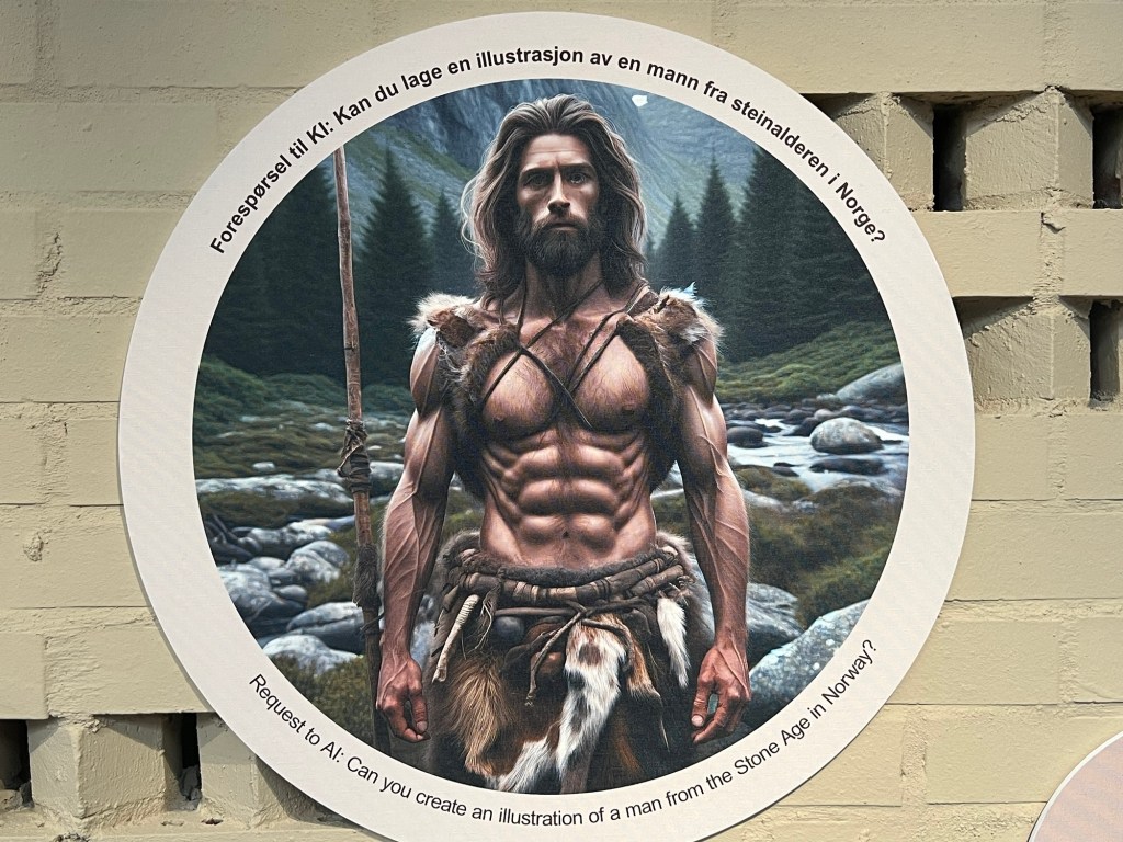
A display at the Museum of Archaeology in Stavanger asks visitors to consider how AI — which bases its “intelligence” on existing images in popular culture as well as research — can reproduce stereotypes of people from the past (photo from my visit on May 20th) As a culture that made its mark across the North Atlantic, Russia, and even parts of the Mediterranean and Near East, the Norse are worth a look for anyone inquisitive about world history. Personally, I am interested in how the Norse encountered other peoples of the world and how these cultures mutually influenced one another. And as a family historian, I am curious to find out what aspects of ancient Scandinavian culture might have been preserved in modern practices and ideas – practices and ideas which my ancestors may have even brought with them across the water.
But I strive to approach all my inquiries with a healthy dose of cultural relativism and social constructionism. Both viewpoints are currently under attack in America today as being “woke” and neither are typically mentioned in genealogical writing. They deserve some amplification here.
Cultural relativism refers to anthropologist Franz Boas’ idea that no culture can be understood according to the standards of another culture; it must be understood within its own cultural context. Were the Vikings violent by 21st century standards? Certainly. Is this an appropriate context to judge them by? Certainly not. Cultural relativism is the natural cure for ethnocentric and present-centric views.
Social constructionism refers to Peter Berger and Thomas Luckmann’s idea that the social phenomena we observe are not simply “out there” – objective realities to be discovered. Instead, they are in large part the product of what we have been conditioned to observe through our interactions with others. Do “white people” exist? Biologically speaking, no. But the social category can exist within a particular social context and such a categorization can have real world effects on life outcomes. This may sound like splitting hairs, but the implication is that if a social phenomenon (like a race, ethnicity, nationality or culture) is a construction, it can be re- or de-constructed. Its boundaries can shift, become porous or solid, or be erased entirely. New meanings can get attached to old categories. Social constructionism is therefore the natural cure for essentialism – the circular, ‘common sense’ logic that things just “are the way they are.” The social constructionist says, “No – things come to be the way they are through a history of interactions, and subsequent interactions can change them.”
These postmodern approaches to culture have their drawbacks. If taken to the extreme, they beg the question: can we say anything about anything? I would argue that any inquiry – academic or personal – requires definitions and categories, and therefore some of the postmodern navel-gazing must be bracketed off, at least temporarily, for us to summarize knowledge and make sense of our world. I would also argue that no amount of postmodernism saves us from the reality that inquiry itself is value laden. We can make good faith attempts to conduct our inquiries free from cultural bias, ethnocentrism and essentialism, but the act of inquiry itself – our choice of subject and methods – makes a statement about our values and positionality. The real question is whether we are aware of these or not.
To bring this essay back to the uncomfortable truth I laid out at the beginning – that Norse culture has been co-opted by racist ideologues over the past century – is it possible to study Norse culture without reinforcing such ideology? I certainly hope so. But I am also aware that one person’s anti-racist inquiry can become fodder for another’s racist inquiry. Once knowledge is put out into the public sphere, it can become perverted by another person’s agenda. I am keenly aware, for example, that I’m writing these words in an era in which artificial intelligence technology can scrape up my thoughts and repackage them for different purposes, different audiences. I can’t possibly know how my words will be used going forward. But I can state my intent and clarify my own views: that Norse culture is worthy of study – not because it encapsulates the lifeways of a supposedly superior people – but because it has been one of countless cultures engaged in a historical dialogue with the rest of world, and some of its internal contradictions are – in my opinion – interesting in and of themselves. And I can also admit my own bias, my own “angle”: that part of my curiosity about this culture relates to how aspects of it may have filtered down to modern practices and folk customs, and perhaps even to those of my own ancestors.
Deep Roots
Reflections on family history, identity and geography
Home
Welcome! I’ve created this site to share family history and collective memories.
